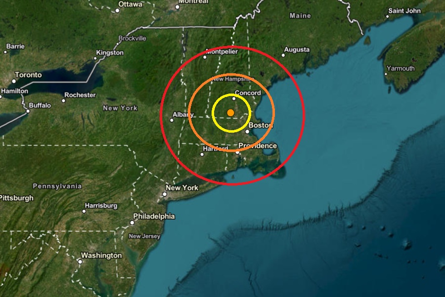
An early morning earthquake rattled portions of New Hampshire early this morning. According to USGS, at 1:54 am, a magnitude 2.1 earthquake struck from a depth of 8.7 km near the town of Milford, which is southwest of Concord and Manchester and northwest of Nashua. Milford is also roughly 50 miles northwest of Boston, Massachussetts. More than 150 people reported to USGS in both Massachussetts and New Hampshire that they felt today’s earthquake via their “Did you feel it?” website reporting tool.
While some people did report feeling or hearing the earthquake to USGS, the earthquake was far too weak to create any damage or injuries.
According to USGS, earthquakes with a magnitude of 2.0 or less are rarely felt or heard by people, but once they exceed 2.0 , more and more people can feel them. While damage is possible with magnitude 3.0 events or greater, significant damage and casualties usually don’t occur until the magnitude of a seismic event rises to a 5.5 or greater rated event.
This earthquake joins several other relatively weak earthquakes to strike the eastern U.S. in recent weeks. Today’s earthquake in New Hampshire joins joining other recent earthquakes in the east in Georgia, Kentucky, Louisiana, Arkansas, Alabama, and Maine.
People in New England, and in its geological extension southward through Long Island, have felt small earthquakes and suffered damage from infrequent larger ones since colonial times. Moderately damaging earthquakes strike somewhere in the region every few decades, and smaller earthquakes are felt roughly twice a year. The Boston area was damaged three times within 28 years in the middle 1700’s, and New York City was damaged in 1737 and 1884. The largest known New England earthquakes occurred in 1638 (magnitude 6.5) in Vermont or New Hampshire, and in 1755 (magnitude 5.8) offshore from Cape Ann northeast of Boston. The Cape Ann earthquake caused severe damage to the Boston waterfront. The most recent New England earthquake to cause moderate damage occurred in 1940 (magnitude 5.6) in central New Hampshire.
Last January, a substantially stronger magnitude 3.8 event struck along the southeast coast of Maine; it was strong enough to trigger an update from the National Tsunami Warning Center although there was no threat of tsunami.
