The public is invited to come out and visit aircraft used to investigate tropical cyclones –as well as the pilots that fly into them at an upcoming “Hurricane Awareness Tour” which has scheduled stops in Portland, Maine, Albany, New York, Norfolk, Virginia, Charleston, South Carolina, and Sanford, Florida from May 6 to May 10. Hurricane scientists will also be available during this special scheduled event which is designed to raise awareness of the importance of preparing for the upcoming hurricane season.
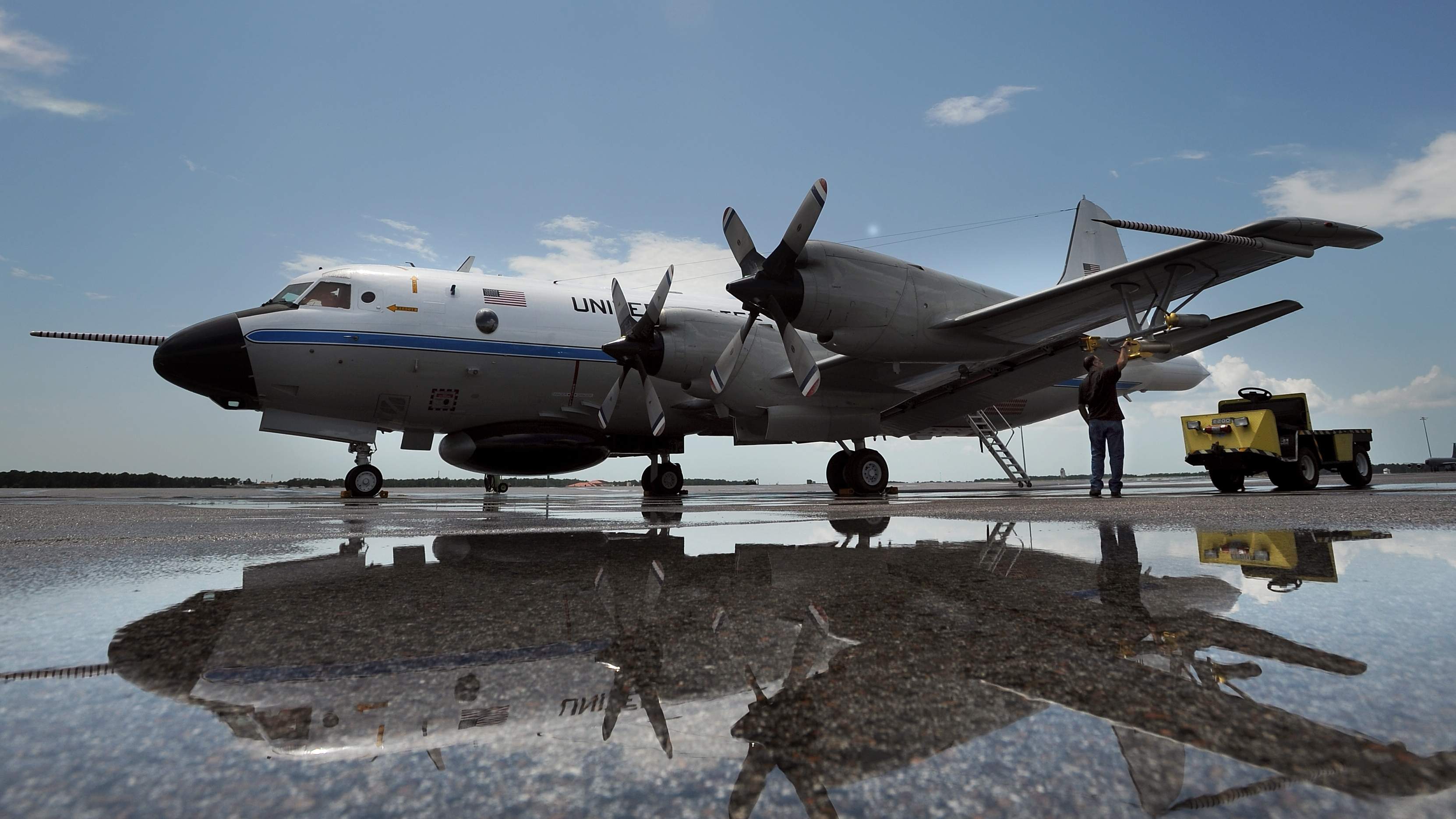
A NOAA WP-3D Orion aircraft and U.S. Air Force Reserve WC-130J will be featured at this five city tour over five days.
The NOAA WP-3D Orion turboprop aircraft is used primarily by scientists on research missions to study various elements of a hurricane, flying through the eye of the storm several times each flight.
Military air crews fly state-of-the-art WC-130J aircraft directly into the core of tropical cyclones to gather data that are critical for forecasting a hurricane’s intensity and landfall. The data are sent in real time via satellite from the aircraft directly to the National Hurricane Center for analysis and use by hurricane forecasters.
In addition to the aircraft, staff from local emergency management offices, FEMA, non-profit organizations such as the American Red Cross, and several local NOAA National Weather Service forecast offices will join the various stops on the tour. Also on the tour is the Federal Alliance for Safe Homes (FLASH), which has an ongoing #HurricaneStrong campaign to re-energize and inspire hurricane readiness by increasing public awareness and action before the next storm strikes.
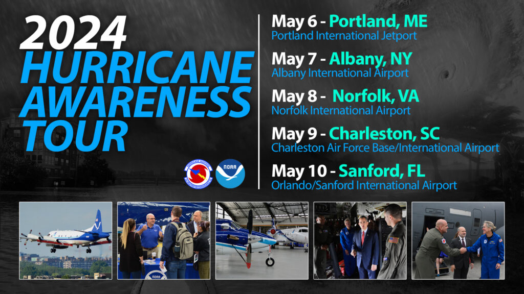
The tour kicks-off at Portland International Airport on Monday, May 6. The public and media are invited to attend there from 9 am – 3pm.
On Tuesday, May 7, the media are invited to attend the tour stop at Albany International Airport from 9:15 am – 3:00 pm.
On Wednesday, May 8, the public and media are invited to attend the tour stop at Norfolk International Airport from 9 am – 3pm.
On Thursday, May 9, the media is invited to attend at Charleston International Airport from 9 am – 3:30 pm.
For the last tour stop on May 10 at the Orlando/Sanford International Airport, the public and media are invited to come out from 9 am – 3 pm.
For the upcoming Hurricane Awareness Tour, @FederalAlliance is one partner that will be helping people of all ages prepare for what experts say will be a very busy Atlantic hurricane season. https://t.co/z1CjoRMkev
— the Weatherboy (@theWeatherboy) April 26, 2024
A variety of NOAA and FEMA leaders will be present at these events. From the National Hurricane Center, Director Michael Brennan, Senior Hurricane Specialist Robbie Berg, and Storm Surge Specialist Cody Fritz will attend. Alex Lamers, a Warning Coordination Meteorologist with NOAA’s Weather Prediction Center will also be present. For the Albany, Norfolk, and Charleston events, David Novak, the Director of NOAA’s Weather Prediction Center will be present.
“It is important for everyone to plan ahead; from individuals, businesses to local governments,” said Lt. Col. Kaitlyn McLaughlin, 53rd Weather Reconnaissance Squadron chief aerial reconnaissance weather officer. “And to help ensure public safety, we fly into harm’s way to gather the weather data and relay that data to the NHC, who can then provide a greater accuracy of forecasting of where a hurricane will strike and the strength of the storm, so the public has the most up-to-date information available.”
The Hurricane Season for both the Atlantic (U.S. East and Gulf coast) and the Central Pacific Basin (Hawaii) begins on June 1.
