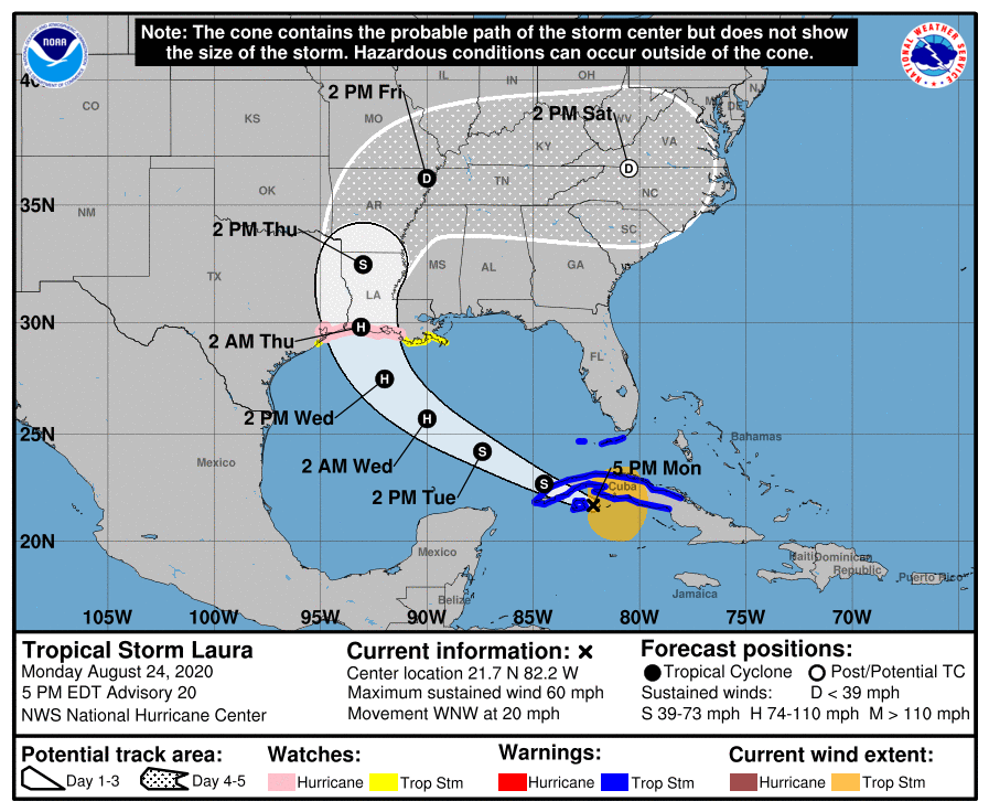
The National Hurricane Center (NHC) in Miami, Florida has issued a fresh round of watches for the central Gulf Coast ahead of what will be Hurricane Laura’s arrival. Watches and warnings in this region were dropped earlier today with Marco; now many of the same people will need to prepare for Laura which could be a disastrous storm.
A Storm Surge Watch is now in effect from San Luis Pass, Texas, to Ocean Springs, Mississippi, including Lake Pontchartrain, Lake Maurepas, and Lake Borgne for areas outside of the southeast Louisiana Hurricane and Storm Damage Risk Reduction System. A Hurricane Watch is in effect from Port Bolivar, Texas, to west of Morgan City, Louisiana. A Tropical Storm Watch is in effect from south of Port Bolivar to San Luis Pass, Texas and from Morgan City, Louisiana to the Mouth of the Mississippi River.
The Tropical Storm Warnings that were up for Little Cayman and Cayman Brac and the Cuban provinces of Camaguey and Las Tunas has been discontinued.
A Storm Surge Watch means there is a possibility of life-threatening inundation, from rising water moving inland from the coastline, in the indicated locations during the next 48 hours.
A Hurricane Watch means that hurricane conditions are possible within the watch area. A watch is typically issued 48 hours before the anticipated first occurrence of tropical-storm-force winds, conditions that make outside preparations difficult or dangerous.
A Tropical Storm Warning means that tropical storm conditions are expected somewhere within the warning area while a Tropical Storm Watch means that tropical storm conditions are possible within the watch area, generally within 48 hours.
When Laura, now a tropical storm, moves away from Cuba, it will enter into the Gulf of Mexico, an area ripe for development. The National Hurricane Center believes rapid intensification of this storm is possible. It is also possible Laura could approach the coast as a major hurricane with winds of 110 mph or worse. Residents in the Hurricane Watch area should take the threat seriously and prepare for Laura’s arrival.
