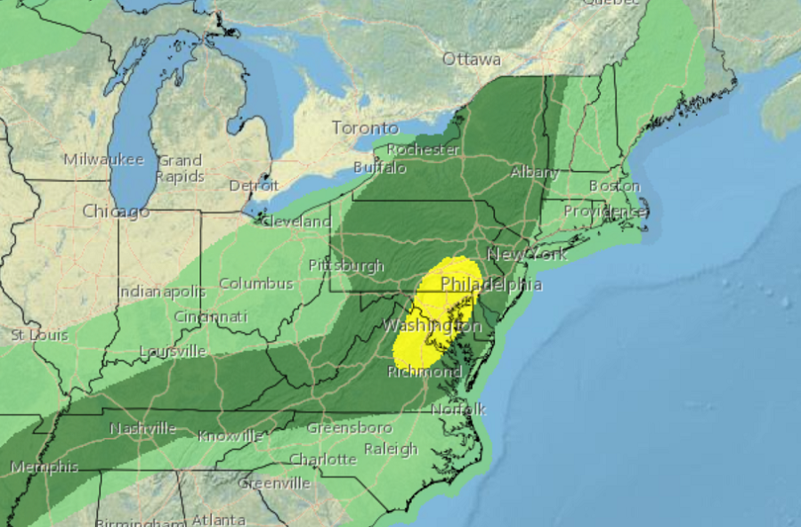
The National Weather Service’s Storm Prediction Center believes there’s a good chance severe thunderstorms will develop in portions of the Mid Atlantic later this afternoon. There is an even greater chance of severe storms tomorrow.
A mesoscale convective vortex, or MCV, is tracking east from the Upper Ohio Valley. A MCV is a low-pressure center within a mesoscale convective system that pulls winds into a circling pattern, or vortex. With a core only 30 to 60 miles wide and 1-3 miles deep, these types of weather phenomena can pack a punch in a relatively small area. The MCV, in conjunction with low-level convergence along the lee trough should aid in at least isolated thunderstorms off the Blue Ridge from central Virginia to southern Pennsylvania. Additional storms will likely develop in the lee of the Lower Great Lakes and spread east. Atmospheric ingredients coming together this afternoon should be sufficient for few supercells to form. These will be capable of producing a risk for at least a couple tornadoes across parts of the Mid-Atlantic region, along with locally damaging winds. The greatest threat of tornadoes and wind damage will be across southeastern Pennsylvania, northern Delaware, northeastern Maryland, and northeastern Virginia. Washington DC and Baltimore are included in this elevated risk area.
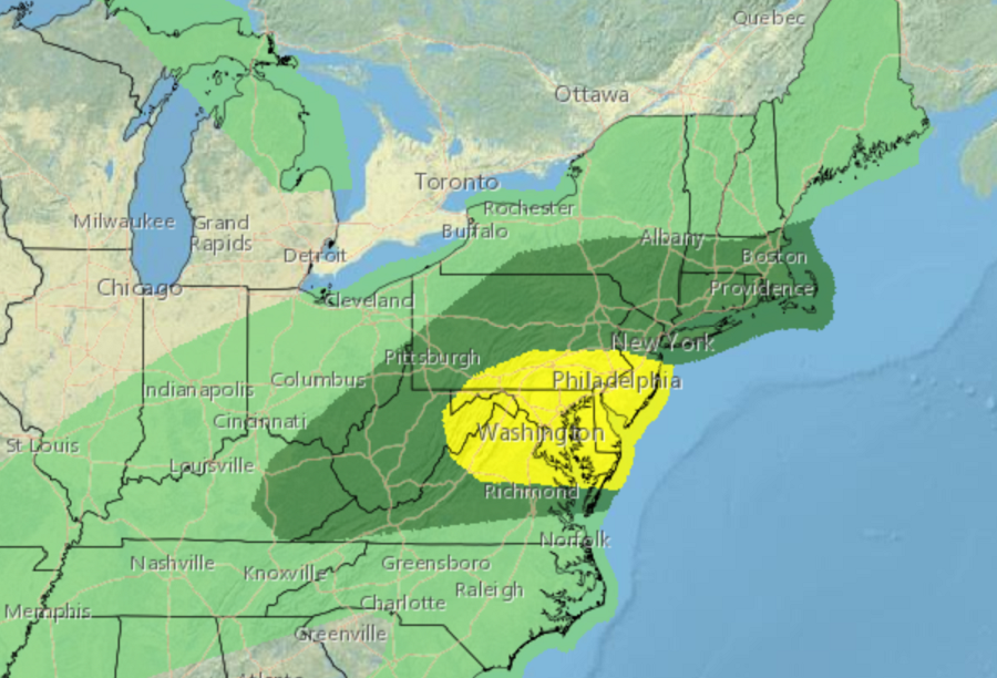
On Thursday, the odds of severe weather will even be greater over portions of the Mid Atlantic. The greatest threat tomorrow will be over southern New Jersey, south central and eastern Pennsylvania, all of Maryland, northern Virginia, and all of Delaware. Damaging wind gusts and a few tornadoes should be the main threats on Thursday, although isolated large hail may also occur. Tornadoes may occur with any initially discrete supercells, as atmospheric dynamics are forecast to provide sufficient veering and strengthening of the low-level winds. This tornado potential appears to be maximized Thursday afternoon along and east of the Blue Ridge Mountains into the I-95 corridor of Maryland and Virginia, including the Washington DC metro area. According to the National Weather Service, at least scattered damaging winds also appear likely later into the afternoon and early Thursday evening across this region and into the Delmarva, as some clustering of storms should occur with eastward extent.
