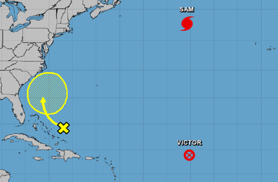
Hurricane Sam continues to spin about in the North Atlantic far away from land; even farther from land is what is left of Tropical Storm Victor which has now dissipated. While these two areas are far away from the United States and moving away, a new area of disturbed weather is capturing the attention from the National Hurricane Center (NHC) for signs of potential development.
A large area of disorganized cloudiness and showers continues over the southeastern Bahamas and adjacent southwestern Atlantic waters in association with a surface trough. According to the NHC, upper-level winds are not expected to be especially conducive for intensification anytime soon and any development of this system should be slow to occur while it moves slowly northwestward through the end of this week. For now, the NHC says there’s zero chance of tropical cyclone formation over the next 48 hours and up to 10% over the next five days.
Computer forecast guidance suggests that even if a tropical cyclone doesn’t development, gusty showers and downpours could impact portions of the East Coast later in the week and next weekend. Either way, forecasters at the National Hurricane Center and National Weather Service will monitor it closely this week.