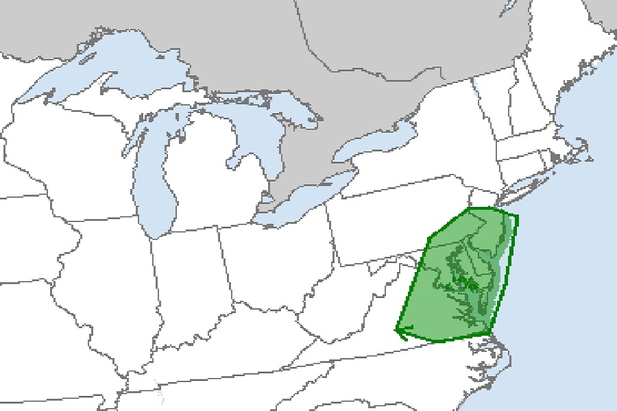
The National Weather Service’s Storm Prediction Center (SPC) is warning about a returning threat of tornadoes to an area that saw multiple tornado touch-downs yesterday. Specifically, the SPC is warning all of Delaware, much of New Jersey and Maryland, southeastern Pennsylvania, and eastern Virginia are at the highest risk of tornadoes in the eastern United States. While most people won’t see tornadic thunderstorms in this region, there is an elevated risk and some people could see tornadoes; that was the case when three hit yesterday in Pennsylvania.
According to the SPC, scattered damaging winds from strong to isolated severe gusts are likely across parts of the Mid-Atlantic States through early evening. A slowly weakening mid-level trough over the Lower Great Lakes will gradually progress across the Northeast through tonight. The SPC says conditions remain favorable for widely spaced multicell clusters that evolve into short-line segments spreading east towards the coast. Hodographs will be relatively straight and modestly elongated, especially with northern extent, but mid-level lapse rates will remain weak. This suggests severe hail will probably remain isolated, but even small hail should help to enhance water-loaded downdrafts. Multiple swaths of at least scattered damaging winds are likely through early evening. Isolated tornadoes are also possible in an area stretching from central New Jersey south into eastern Virginia.
Yesterday, 4 tornadoes touched-down in Pennsylvania from yesterday’s severe weather outbreak. According to the National Weather Service, there were reports of two separate funnel cloud circulations around Columbia, Pennsylvania; one on Red Bank Road and the other on Route 45 near Carrolton Road that touched down and was confirmed as a tornado. The next was in Northumberland where a trained spotter reported a large wedge shaped tornado on the ground between Grange Hall Road and Route 80 near Milton. A second funnel cloud was also spotted 1/2 mile to the south of here. Lastly, two tornadoes were reported in Dickson City in Lackawanna, damaging homes and properties there.

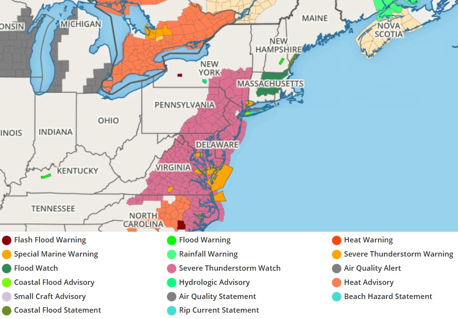
For now, the National Weather Service has issued a large area in the Mid Atlantic a Severe Thunderstorm Watch. Within and around this watch area, Severe Thunderstorm Warnings or Tornado Warnings may be issued when such a danger materializes in a specific county or counties. The expansive watch area extends from central New York south into North Carolina and includes the cities of Washington DC, Norfolk, Baltimore, Philadelphia, Atlantic City, and New Brunswick. New York City is currently not under any watch or warning.