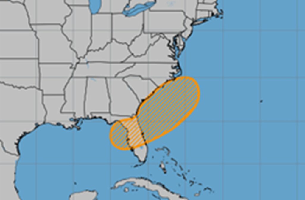
The National Hurricane Center has increased their odds that a tropical or subtropical storm could form over the upcoming holiday weekend near Florida. Meteorologists at the National Hurricane Center (NHC) want people along the northeast Gulf of America coast and the southeast U.S. East Coast to keep an eye on this area as the Fourth of July Holiday Weekend arrives should a system develop. They boosted odds that something would form here from 20% to 40%.
According to the NHC’s latest Tropical Outlook, an area of low pressure could develop near the southeast U.S. Atlantic or Gulf coasts by this weekend along a weakening frontal boundary.
“Environmental conditions appear only marginally conducive for some slow development, but a tropical or subtropical depression could form in this region over the weekend or early next week while the system drifts northward or northeastward,” the NHC wrote in their Tropical Outlook update today.
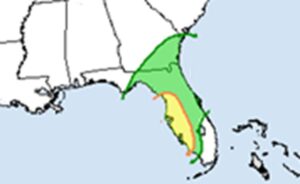
Even if a system doesn’t take shape, very heavy rainfall is possible across portions of the southeast U.S. in the coming days, particularly across the west-central Florida coast. The National Weather Service’s Weather Prediction Center is warning about the increasing changes of excessive rainfall which could lead to extensive flooding and flash flooding across portions of southeastern Georgia and much of central Florida, with the greatest risk along Florida’s central Gulf coast which includes Tampa and Fort Meyers.
The 2025 Atlantic Hurricane Season began on June 1 and runs through November 30. There have been two storms to date so far this season: Andrea and Barry. Andrea formed over the open waters of the central Atlantic on June 24. Barry formed near the Bay of Campeche and moved into Mexico on June 29. No hurricanes have yet to form this season.
