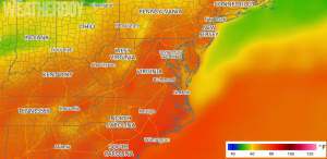
After a slow moving low pressure system wraps up its role of an east coast soaker, it appears a scorcher may quickly follow as very warm high pressure builds in.
A complex low pressure system, already responsible for more than 6″ of rain in portions of the southeastern United States, will push up the east coast today, bringing very wet weather to the I-95 corridor from Washington, DC to New York City, NY. Conditions may be especially messy during the PM drive today in New York City and Long Island when rain is heaviest then. Heavy rain could create some flooding issues, especially in poor drainage areas. With winds whipping up at the coast from this coastal system, there could also be coastal flooding at times of high tide.
Once this area of low pressure exits, high pressure will build into the eastern United States, pumping very warm temperatures up the coast. On Saturday, 90 degrees could be hit in Washington, DC while 85 is likely in Philadelphia, PA. Even New York City will reach into the 80s as partly to mostly sunny skies build in for the weekend.
With the heat will come some humidity and the threat of scattered showers and thunderstorms. There doesn’t appear to be a severe weather threat yet in the eastern US this weekend, but that could change early next week as a potent cold front moves through.