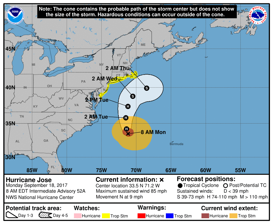
People along the Mid Atlantic and New England coasts from Delaware to Massachusetts are preparing today for Hurricane Jose’s arrival tomorrow; the looping hurricane has had an unusual track that will likely only become more unusual after time. Sometime late Tuesday as the center of Jose passes well off the Jersey Shore, it should weaken from a hurricane to a tropical storm; it’s also possible it may structurally change to a subtropical or post-tropical storm. Either way, the impacts will be the same: heavy rain and gusty winds will be generated by the storm along with ocean impacts of beach erosion, coastal flooding, rough surf, and dangerous rip-currents. As the transformation from a hurricane begins, the wind field around Jose will widen; while the wind speeds in the storm won’t increase, the area of tropical storm force winds will extend far from the center.
Because of that threat of expanding winds which would reach land even though the center of the storm is forecast to remain well off-shore, Tropical Storm Watches remain up from Fenwick Island, Delaware to Sandy Hook, NJ and East Rockaway Inlet, NY to Plymouth, MA. The Tropical Storm Watch includes Block Island, Nantucket, and Martha’s Vineyard. A Tropical Storm Watch means tropical storm conditions, with sustained winds greater than 39mph, are possible within 48 hours.
The coast will be brushed by strong winds and heavy rains, with southeastern New England bearing the brunt. While the worst of the storm is expected to remain over the open ocean, and drift further west from the expected forecast track could bring storm conditions further inland. While the Tropical Storm Watch is up for coastal counties, it is important that people even inland in the states with Watches be closely monitoring this storm and be prepared for the possibility of a track closer to the coast. While tracks closer to the coast are possible, a direct impact is not expected for now. As the storm drifts east southeast of Cape Cod, it could loop back around towards the East Coast. Depending on atmospheric steering currents then at the end of the week, and the location and influence of Hurricane Maria, it is possible Jose could come back to land near the Delmarva or New Jersey by the weekend in a weakened state.
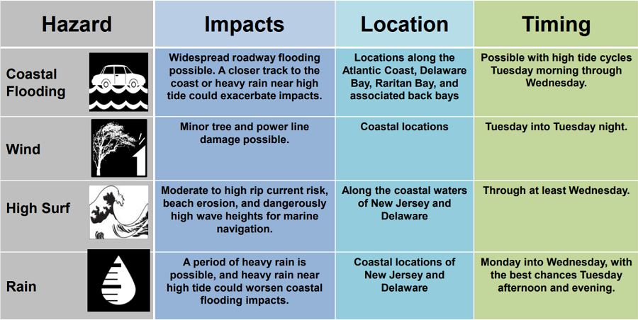
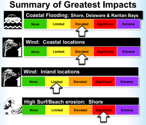
Before such a loop back to the coast possibility occurs, there will be immediate impacts from Jose. The National Weather Service Office in Mount Holly, NJ, responsible for areas in Delaware and New Jersey that will see the first direct impacts of rain and wind from this storm, has released a public briefing report for the storm. In it, they warn of coastal flooding, damaging wind, high surf, and flooding rain risks from Jose. In their briefing, they disclose that the coastal area has an elevated risk of wind issues while inland locations are only “limited” in their risks. The risk of high surf and beach erosion at the shore is classified as “significant” and residents and tourists there should stay away from the ocean and the dangers that’ll exist there as Jose moves up the coast.
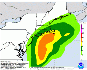 Jose will be a heavy rain maker, although the heaviest rain should remain over the ocean. 1-2″ of rain is possible over the immediate coast of Delaware and New Jersey with locally higher amounts at the northern beaches at the Jersey Shore. 2-4″ is expected across much of Long Island, southeastern Connecticut, northern Rhode Island, and central and eastern Massachusetts. But closer to the storm center, much heavier rain is expected over eastern Long Island, southern Rhode Island, Cape Cod, Nantucket, Block Island, and Martha’s Vineyard; there, 4-6″ and locally 6-10″ of rain is possible, all of which could produce serious fresh water flood issues.
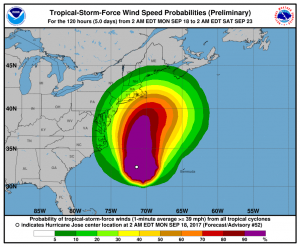
Winds from Jose will also be limited in their reach, similar to the precipitation shield. tropical storm force winds greater than 39mph are possible along Delaware Beaches and the Jersey Shore, across much of Long Island, and extreme southeastern new England.
Experts believe this Atlantic Hurricane Season, which runs through to the end of November, will be a busy one. Dr. Phil Klotzbach and the experts at Colorado State University updated their seasonal outlook again on July 5, showing a much more active than normal season expected. The National Oceanic and Atmospheric Administration (NOAA) also released their own forecast which shows this hurricane season to be likely more active than others.