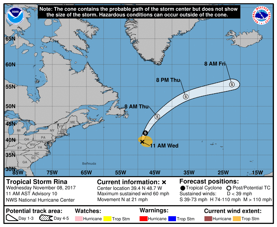
Tropical Storm Rina is beginning to lose some strength, but it’s also beginning to pick up extratropical cyclone characteristics. In the latest advisory from the National Hurricane Center (NHC), the center of Tropical Storm Rina was located near latitude 40.9 North, longitude 48.6 West. Rina is moving toward the north near 23 mph. A turn toward the north-northeast is expected overnight, followed by a rapid northeastward motion on Thursday and an east-northeastward motion on Friday.
Maximum sustained winds have decreased to near 50 mph with higher gusts. Winds earlier today were up to 60mph. Little change in strength is forecast during the next 48 hours, and Rina is expected to become a post-tropical cyclone by early Thursday morning. While losing wind speed, it is picking up size. Rina is becoming a larger tropical cyclone with tropical-storm-force winds extend outward up to 205 miles mainly to the east of the center.
The estimated minimum central pressure is 995 mb (29.39 inches).