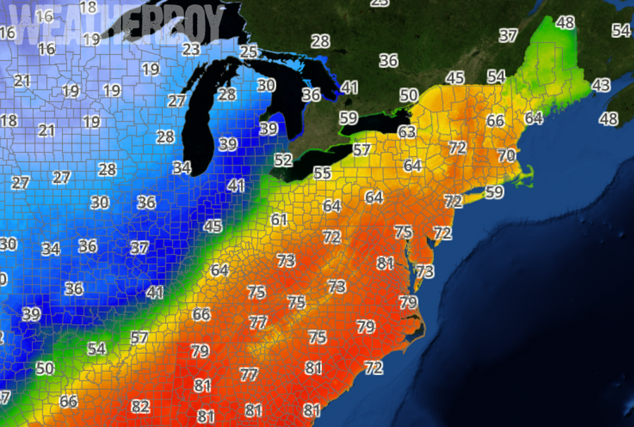
A Bermuda High will blast the US East Coast with a surge of warm air, helping shatter temperature records from south to north. Mid 70s will reach into central New England while low 80s will push into the central parts of the Mid Atlantic. Warm, muggy conditions will also exist in the southeast, with temperatures in the 80s expected throughout Florida.
The Bermuda High responsible for this week’s warm air surge will slowly drift to the south and east through the day on Wednesday. A cold front will then approach late Wednesday and pass through the Mid Atlantic region Wednesday night, becoming nearly stationary.
As the front stalls out, inclement weather will return, bringing a soggy and cool end for a rather warm mid-week. Several waves of low pressure will pass along this boundary through the weekend, generating rain from the Mississippi River and Ohio River Valleys eastward.