The Climate Prediction Center (CPC) within the National Oceanic and Atmospheric Administration (NOAA) has released their 2018-2019 Winter Outlook. According to the outlook, much of the United States could see a milder than normal winter; this is especially true for the western United States, Alaska, and Hawaii where El Nino is forecast to form and influence the weather around the Pacific. And while Hawaii is forecast to have a very dry winter, the southeastern United States is expected to have a very wet winter. NOAA’s seasonal outlooks give the likelihood that temperatures and precipitation will be above-, near- or below-average, and how drought conditions are expected to change, but the outlook does not project seasonal snowfall accumulations.

NOAA’s Climate Prediction Center updates the three-month outlook each month. The next update will be available on Nov. 15.
“We expect El Nino to be in place in late fall to early winter,” said Mike Halpert, deputy director of NOAA’s CPC. “Although a weak El Nino is expected, it may still influence the winter season by bringing wetter conditions across the southern United States, and warmer, drier conditions to parts of the North.” El Nino is an atmospheric/oceanic interaction that is linked to periodic warming in sea surface temperatures in the central and eastern equatorial Pacific. During the winter, typical El Nino conditions in the U.S. can include wetter-than-average precipitation in the South and drier conditions in parts of the North.
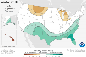
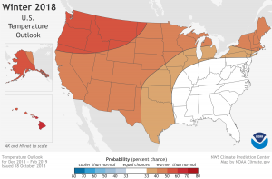
One place where impacts from El Nino are expected to be the greatest is Hawaii. Located in the heart of El Nino waters, the NOAA outlook confidently is calling for much above normal temperatures and much below normal precipitation.
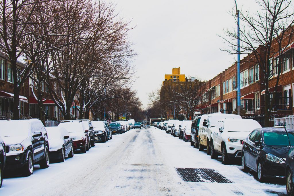
While El Nino could lead to milder than normal conditions across much of the United States, cold and snow is still likely from time to time. According to the CPC, “Even during a warmer-than-average winter, periods of cold temperatures and snowfall are still likely to occur.”

Beyond El Nino, CPC scientists also explore other climate systems and cycles that could influence the upcoming season’s weather.
Other climate patterns that can affect winter weather are challenging to predict on a seasonal time scale, such as the Arctic Oscillation (AO), and the Madden-Julian Oscillation (MJO). The Arctic Oscillation influences the number of arctic air masses that penetrate into the South and could result in below-average temperatures in the eastern part of the U.S. The Madden-Julian Oscillation can contribute to heavy precipitation events along the West Coast – which could play a large role in shaping the upcoming winter, especially if El Nino is weak, as forecasters predict.
Temperature
-
Warmer-than-normal conditions are anticipated across much of the northern and western U.S., with the greatest likelihood in Alaska and from the Pacific Northwest to the Northern Plains.
-
The Southeast, Tennessee Valley, Ohio Valley and Mid-Atlantic all have equal chances for below-, near- or above-average temperatures.
-
No part of the U.S. is favored to have below-average temperatures.
Precipitation
-
Wetter-than-average conditions are favored across the southern tier of the U.S., and up into the Mid-Atlantic. Northern Florida and southern Georgia have the greatest odds for above-average precipitation this winter.
-
Drier-than-average conditions are most likely in parts of the northern Rockies and Northern Plains, as well as in the Great Lakes and northern Ohio Valley.