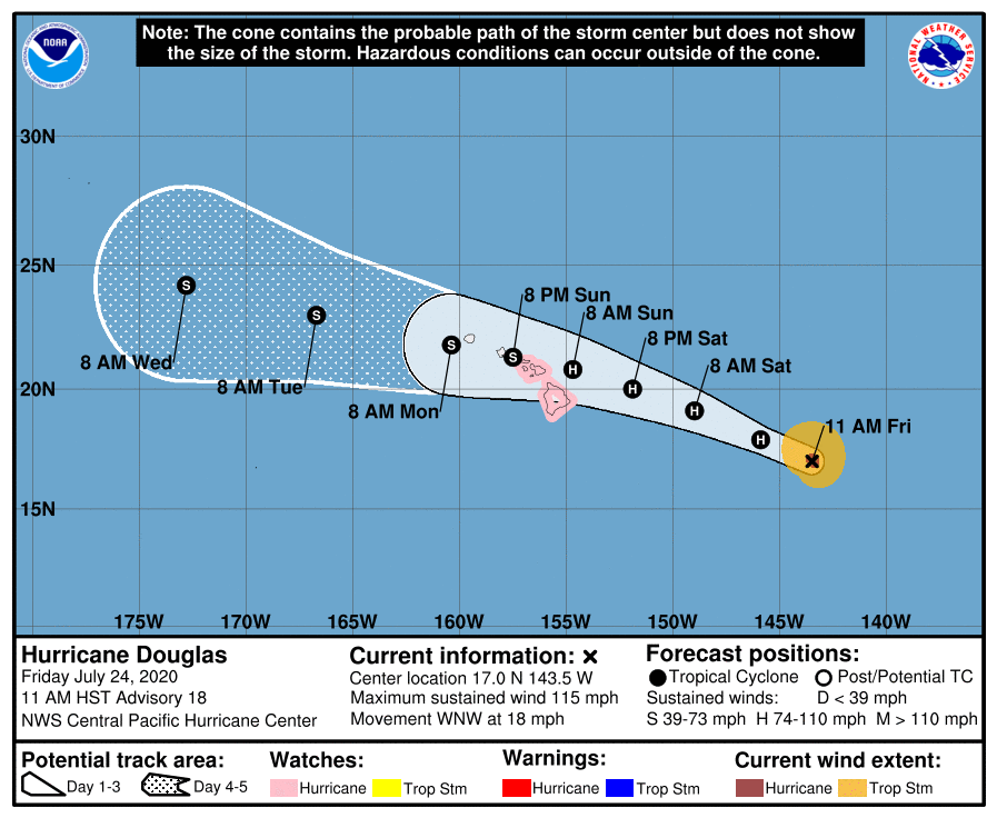
The Central Pacific Hurricane Center in Honolulu, Hawaii has issued a Hurricane Watch for Hawaii and Maui counties in the Aloha State. Hawaii county is the entirety of Hawaii Island, also known as the Big Island. Maui county includes the islands of including Maui, Lanai, Molokai and Kahoolawe. A Hurricane Watch means that hurricane conditions are possible within the watch area, in this case within 36 to 48 hours.
The onward march of Major Hurricane Douglas from the eastern Pacific to the central Pacific has prompted the issuance of the watch.
As of 11am HT (5pm ET), the center of Major Hurricane Douglas is located at 17.0N 143.5W, roughly 785 miles east south east of Hilo and 985 miles east south east of Honolulu. Maximum sustained winds are 115 mph while the minimum central pressure is estimated to be 967 mb or 28.56″.
Douglas is moving toward the west-northwest near 18 mph. This motion is expected to continue for the next two days, followed by a slight decrease in forward speed and a turn toward the west. On the forecast track, Douglas will be near the main Hawaiian Islands on Sunday and Monday.
The approach of Major Hurricane #Douglas to Hawaii over the last 3 days! ? #HIwx pic.twitter.com/UtX9c4Bu91
— the Weatherboy (@theWeatherboy) July 24, 2020
While Douglas is a category 3 hurricane on the Saffir-Simpson Hurricane Wind Scale now, gradual and steady weakening is expected to continue through the weekend. However, Douglas is still forecast to be near hurricane strength when it nears the islands.
Right now, hurricane-force winds extend outward up to 25 miles from the center and tropical-storm force winds extend outward up to 115 miles. While maximum sustained winds are forecast to decrease over time, the actual wind field around the storm is expected to be broadened.
Specific impacts across the state will vary based on exact storm track and influence with the mountainous terrain of Hawaii. Haleakala on Maui rises to over 10,000 feet while the volcanic mountains of Mauna Kea and Mauna Loa rise to over 13,000 feet on Hawaii’s Big Island. These tall mountains will disrupt the flow around the storm, helping shelter some from clouds, rains, and winds, while making rain and wind worse for others. While the southwest corner of Maui and Hawaii islands have best odds of getting through this storm unscathed, it’s imperative everyone plan for the worst anyway. A simple shift by just a few miles could lead to a totally different local weather situation and how that pans out won’t be known until it actually happens or right before.
Recent computer forecast guidance has shifted the possible future track through the islands north, bringing the center of the storm over Maui or Oahu rather than Hawaii. However, subsequent model runs can just as easily shift things back south to Hawaii. In a media briefing at 11am HT, Central Pacific Hurricane Center Director Chris Brenchley cautioned people not to focus on the precise forecast path track, but instead prepare for the possibility of widespread issues from heavy rain, rough surf, and damaging winds.
NOAA’s Central Pacific Hurricane Center (CPHC) Director, Chris Brenchley, described to us today how his Honolulu team coordinates, collaborates, & even swaps staff with Miami-based National Hurricane Center (NHC) to keep America #HurricaneStrong?@NWSHonolulu pic.twitter.com/W1WM2EeXeC
— the Weatherboy (@theWeatherboy) May 23, 2019
Due to the varied terrain, Maui and Hawaii Islands enjoy multiple climate zones. In the interaction with these terrains and climate zones, tropical cyclones will bring equally varied conditions. There could be radically different weather conditions across short distances as well as on each island. Not everyone will experience the same conditions from the storm, even if they’re only 10 miles apart. As is usually the case, it’s best to prepare for the worst and hope for the best.

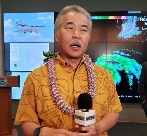
Yesterday, Hawaii Governor David Ige declared an Emergency Disaster Declaration. “Our top priority is always the safety, health and well-being of our residents and visitors. Please take immediate steps to protect your families, loved ones, employees and property. We ask everyone to closely follow emergency instructions as we prepare for Hurricane Douglas,” said the Governor.
While more specifics will be known as the storm nears, Hawaii, especially those currently under a Hurricane Watch, can expect to see severe winds, flooding rains, and rough surf. Hurricane force wind conditions are possible on the Big Island late Saturday night and Sunday, with tropical storm conditions possible by Saturday evening. Hurricane conditions are possible over Maui county Sunday, with tropical storm conditions possible beginning late Saturday night. Large swells generated by Douglas are expected to begin affecting portions of the Hawaiian Islands on Saturday. These swells are likely to cause life threatening surf and rip current conditions for a couple of days. Even the most experienced swimmers and surfers should stay out of the ocean until the storm passes. Heavy rainfall associated with Douglas is expected to affect portions of the Hawaiian Islands from late Saturday night through Monday. Total rain accumulations of 6-10″ with isolated maximum totals of 15″ are possible, especially in higher terrain. This rain may result in life-threatening flash floods, rock, and land slides.