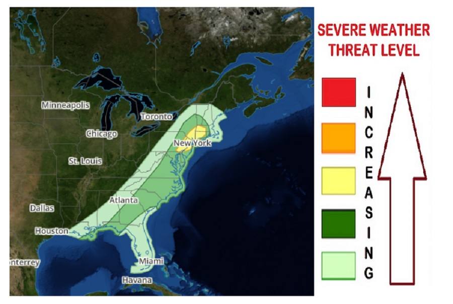
Another round of severe weather is expected in portions of Pennsylvania, New York, and New Jersey tomorrow as yet another in a series of frontal systems moves through. Today, the storm system responsible for this week’s severe weather outbreak is bringing tornadoes, damaging winds, and large hail to portions of the mid-Mississippi River Valley. It will shift east tomorrow, shifting the focus area of severe weather to an area stretching from southeastern Pennsylvania across New Jersey, the New York City metro area, and into south-central New England. As the weather shifts east tomorrow, it won’t be nearly as severe as it is today, but hazardous conditions are still possible nevertheless.
According to the National Weather Service’s Storm Prediction Center, an isolated threat for strong/damaging thunderstorm winds may exist across parts of the Mid-Atlantic and New England on Thursday, and on southward to the Southeast. Marginally severe hail also appears possible in some areas. While there is a risk of isolated tornadoes, the greatest hazard present tomorrow will be from the damaging wind gust potentially, especially over eastern Pennsylvania, New Jersey, the New York City metro area, western Massachusetts, and much of Connecticut.
As a strong upper low over the north-central U.S. Thursday morning shifts gradually northeastward across the Upper Great Lakes and into western Ontario, the upper flow field across the western and central U.S. will become increasingly zonal. In the East, weak mid-level height falls will occur, as short-wave ridging is slowly pushed along to the east across the western Atlantic by the northeastward advance of the aforementioned low. At the surface, a cold front will advance east of the Appalachian Crest during the morning, and across the East Coast states during the afternoon. By late evening the front will likely have cleared the southern New England and Middle Atlantic coasts, lingering only across the Southeast through the end of the period.
