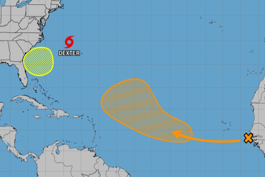
While Tropical Storm Dexter gains strength and moves away from the U.S. East Coast and Bermuda, concern is growing for two other potential systems in the Atlantic Hurricane Basin that could each become threats to the U.S. East Coast over time.
Right now, Tropical Storm Dexter is located roughly 255 miles northwest of Bermuda packing maximum sustained winds of 45 mph. Its minimum central pressure is down to 1002 mb or 29.59″.
Dexter is moving toward the east-northeast near 12 mph. According to the National Hurricane Center, a faster east-northeastward or northeastward motion is expected through early Tuesday, followed by a slower motion Tuesday and Wednesday. Some slight strengthening is forecast during the next couple of days. However, Dexter is likely to become post-tropical by Wednesday.
On the current track, Dexter will miss the United States, Canada, and Bermuda. There could be some rip currents across the Mid Atlantic coast, but that threat should diminish with time.
While Dexter will miss the U.S., the East Coast may not be as lucky with two other systems the National Hurricane Center is tracking.
The first threat could develop off the southeast coast. According to the National Hurricane Center, a broad area of low pressure is forecast to develop in a couple of days a few hundred miles off the coast of the southeastern United States. Some gradual development of this system is possible during the middle or latter portion of this week as the system drifts slowly westward to northwestward. Right now, the National Hurricane Center says there’s a 30% chance that a tropical cyclone will form here over the next 7 days.
The National Hurricane Center believes there’s even better odds that a disturbance moving off of Africa will develop into a tropical cyclone. According to their latest Tropical Outlook, a tropical wave moving off the west coast of Africa is currently producing only limited shower activity. In a few days, environmental conditions are forecast to become favorable for gradual development of this system, and a tropical depression could form by the latter portion of this week as it moves generally west northwestward across the central tropical Atlantic. Some global computer forecast models project this will be a robust tropical cyclone that could impact the U.S. East Coast more than a week away. For now, the National Hurricane Center gives it a 50/50 chance of developing into a tropical cyclone over the next 7 days.
