While it’s been clear Hawaii would not be impacted by the wind and rain associated by Hurricane Kiko which passed to the north of the state and weakened to a tropical storm over the last 24 hours, some were hoping that the surge of moisture entering the region from the storm combined with an altered trade wind pattern due to Kiko’s presence would bring rain. Unfortunately for the Aloha State, there was no significant, widespread soaking rains at all, which will simply worsen the drought conditions Hawaii finds itself in.
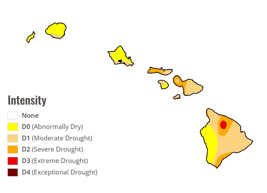
Drought is currently a serious issue in Hawaii, with approximately 40% of the state experiencing drought conditions as of early September 2025, affecting water resources, agriculture, and increasing wildfire risk. Conditions are especially severe on the Big Island, where some areas face extreme drought, impacting livestock water supplies and agricultural operations. An additional 18% of the state is classified as abnormally dry.
Wildfires have burned in recent days on most of the islands, with the Big Island of Hawaii seeing a 500+ acre blaze within a zone classified as “Extreme Drought” by Drought Monitor.
While Hawaii missed out on getting rain from Kiko, it did miss out from getting very dry air which is a blessing. The same wasn’t the case in August 2024 when dry air entering the region from a passing tropical cyclone set up a perfect storm of fire weather conditions. In that event, where winds whipped up flames across both the islands of Maui and the Big Island of Hawaii in Hawaii on August 8, 2024, there was no helpful precipitation from the storm which led to the tragedy seen in Lahaina on the Island of Maui.
While Hawaii may be best known for its tropical breezes, sun-drenched beaches, and tropical rain forests, a federal analysis of wildfire risk to communities shows that of all 50 states, Hawaii has by far the highest risk of “fire consequence” — the likelihood of high-intensity fires near homes.
According to the National Weather Service, “fire weather” is the use of meteorological parameters such as relative humidity, wind speed and direction, mixing heights, and soil moisture to determine whether conditions are favorable for fire growth and smoke dispersion. Over the last 16 years, Hawaii has seen such fire weather conditions develop in every month but February, with August being the primary month for fire weather conditions.
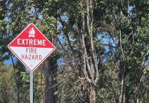
When it appears a combination of strong winds, low relative humidity levels, and dry fuels contribute to extreme fire behavior, the Honolulu office of the National Weather Service will issue a Fire Weather Watch for the entire state. When key criteria is met in the short-term, the Fire Weather Watch is upgraded to a Red Flag Warning, generally within 24 hours of when the fire weather conditions are expected.
One key metric looked at by meteorologists studying fire weather is the Keetch-Byran Drought Index (KBDI). According to the Honolulu office of the National Weather Service, the usual KBDI index reaches the 600 mark in late July or early August, showing the threat of possible red flag warning conditions. The KBDI is a number representing the net effect of evapotranspiration and precipitation in producing cumulative moisture deficiency in deep duff and upper soil layers. It is a continuous index, relating to the flammability of organic material in the ground. When the KBDI is 0-200, soil moisture and large class fuel moistures are high and don’t contribute much to the intensity of fire. With a KBDI of 200-400, lower litter and duff layers are drying and begin to contribute to fire intensity. When the index reaches 400-600, lower litter and duff layers actively contribute to fire intensity and will burn actively. The 600-800 score represents conditions typical of severe drought with increased wildfire occurrence. With a KBDI over 600, intense, deep burning fires are possible while live fuels can be expected to burn actively too.
In Hawaii, a Red Flag Warning is triggered when the KBDI is over 600, minimum relative humidity is less than or equal to 45% for 2 or more hours, and the wind is sustained at 20 mph or more for 2 hours or more.
Since 2012, the National Weather Service has issued Red Flag Warnings more than 50 times for Hawaii.
These Red Flag Warning days now have greater awareness in Hawaii; the primary electrical utility in the state, Hawaiian Electric, rolled out a Public Safety Power Shutoff or PSPS program for the entire state on July 1. The utility has announced that they will proactively shut down portions of their electrical grid in high fire danger zones around the state when Red Flag Warning and/or other key criteria is met. Hawaiian Electric has said since this is their first year of the program, the criteria to determine which zones are disconnected could change.
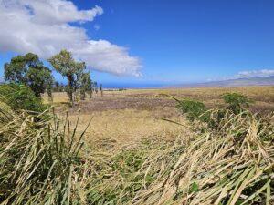
According to the Hawaii Wildfire Management Organization, about 0.5% of Hawaii’s total land area burns each year, equal to or greater than the proportion burned of any other US state. Over 98% of wildfires are human caused. Human ignitions coupled with an increasing amount of nonnative, fire-prone grasses and shrubs has made the threat of wildfire worse throughout Hawaii.
