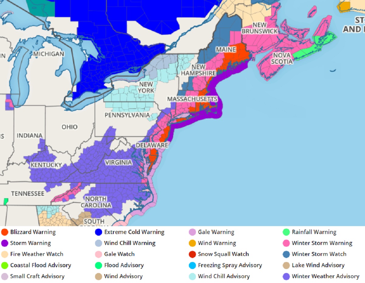
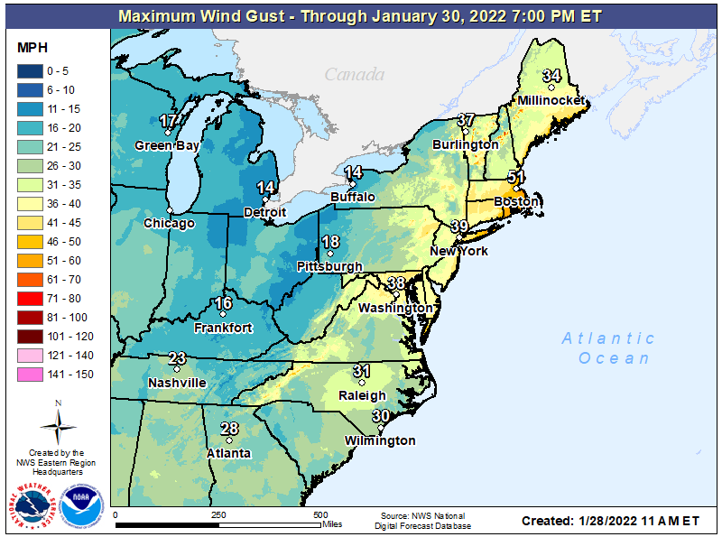
The National Weather Service has expanded Blizzard Warnings and Winter Storm Warnings up and down the east coast from Virginia to Maine as a massive Blizzard Bomb begins to unfold. Heavy snow measured in feet and strong, potentially damaging winds in excess of 40 mph will combine for several hours to create true blizzard conditions –a condition that hasn’t hit the region in several years. As an example, the last time a Blizzard Warning was issued for the Jersey Shore was January 4, 2018.
While the phrase “blizzard bomb” sounds like meteorological hyperbole, the words are actual meteorological terms with scientific definitions. The storm system responsible for the blizzard bomb will be just that: an area of low pressure that is due to meteorologically “bomb” while blizzard criteria is expected to be reached over a rather broad area.
While many people think a blizzard is simply a big snowstorm, they’re wrong. A blizzard is all about wind and visibility. According to the National Weather Service, three criteria must be reached before a storm is considered a blizzard. First, there needs to be sustained winds of 35 mph or frequent gusts over 35 mph. Second, due to the weather, the visibility must be reduced to 1/4 mile or less. This reduction can happen from falling heavy snow …or it could simply be previously fallen snow blowing about in the wind. You do not need fresh snow to be falling to reach blizzard criteria. Third, to count as a blizzard, the reduction in visibility and the strong winds must last for at least three hours. When all three of these conditions are met, you have more than a snowstorm: you have a full-fledged blizzard!
For this storm, blizzard conditions are expected along Virginia, Maryland, and Delaware beaches, the Jersey Shore, Long Island, southeastern New England, and the coasts of New Hampshire and Maine. The worst blizzard conditions with the highest winds are likely over extreme southeastern New England at/around Boston and Cape Cod.
We shared this map earlier today and see no reason at this time to change it. Get ready for the #BlizzardBomb of ’22!
More info & maps:https://t.co/BTtCPt6jf9 pic.twitter.com/Og0X4MFztf
— the Weatherboy (@theWeatherboy) January 28, 2022
When all is said and done, more than 1 foot of snow will blanket the east coast from Virginia to Maine, with more than 2 feet of snow possible over southeastern New England. A pocket of 3’+ snowfall is expected too and snowstorm totals to 40″ are within the realm of possibilities for the blizzard bomb.
While snow totals will be heavy, the snow will be of the light and fluffy variety. With fluffy snow, the threat of structural collapse is lower because the weight of the snow isn’t heavy due to being more wet. However, fluffy snow will blow and drift more than wet snow, resulting into massive snow drifts that will be measured in yards rather than feet. Wind will blow and drift snow reducing visibilities even after the fresh snowfall stops, resulting in blizzard conditions even after the snow wraps up.
Strong winds may also help topple trees and wires, resulting in power outages. Due to utility crews unable to get out and about due to the deep snow, some power outages could last several days or longer. Residents in the Blizzard Warning area should prepare for that possibility –especially if it means a power outage leaves them without heat for a prolonged period of time.
Snow will spread from southwest to northeast later today, with the heaviest snow likely from early Saturday to Saturday afternoon for many areas. Snow should linger in Maine Sunday morning, with snow completely exiting the U.S. by lunchtime Sunday. Behind the storm, cold northwest winds will drive temperatures down, with winds bringing the apparent temperature even lower with frigid wind chill factors.
In the wake of the blizzard bomb, conditions should be tame for at least 3-4 days in the east with no new storms expected in the near term.
