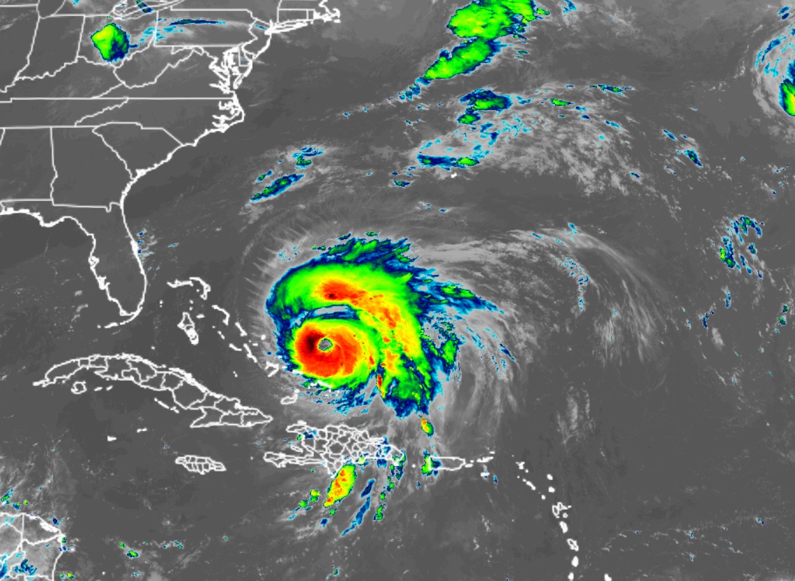
Hurricane Fiona intensified into a Category 4 Major Hurricane and now has maximum sustained winds of at least 130 mph; by the end of the week, this mighty storm could impact an area that rarely sees hurricanes, let alone major hurricanes: Atlantic Canada.

Today, the fierce storm is spinning about just east of the central Bahamas. Heavy rains south of Fiona will continue to impact the Turks and Caicos through tonight with additional flooding possible. Fortunately, the worst of the winds will remain away from the Bahamas.
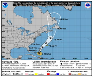
Bermuda may be lucky to miss out on the worst of the storm too. The National Hurricane Center (NHC) says that tropical storm conditions are possible on Bermuda by late Thursday. In the latest NHC forecast, the center of Fiona will pass just west of Bermuda as a major hurricane. Authorities have issued Tropical Storm Watches for Bermuda; while the worst of Fiona should pass west of Bermuda, outer bands of gusty winds and heavy rain could lash the island. People in Bermuda should closely monitor evolving forecasts; any shift in track closer to the island could create extremely dangerous conditions.
After passing Bermuda, Fiona’s next target could be Canada. It looks like Fiona will impact Atlantic Canada around Nova Scotia as a powerful hurricane-force cyclone late Friday and Saturday, and could produce significant impacts from high winds, storm surge, and heavy rainfall.
While the National Hurricane Center tracks tropical cyclones for the United States, Environment Canada is the federal agency responsible for doing the same in Canada. Environment Canada released this statement:
Hurricane Fiona expected to impact Atlantic Canada land areas Saturday and southern offshore areas Friday.
This storm is shaping up to be a potentially severe event for Atlantic Canada. Numerous weather models are quite consistent in their prediction of what we call a deep hybrid low pressure system, possessing both tropical and intense winter storm-type properties (but with very heavy rainfall).
Currently the range of uncertainty with regard to the centre of the low when it approaches late Friday or Saturday is approximately a 600 to 700 kilometre wide zone (“cone of uncertainty”) centered near eastern Cape Breton with a broad coverage of hurricane-force winds including over land. This is the most likely scenario as we see it now, regardless of meteorological classification of ‘Hurricane’, or ‘Post-Tropical Storm’ Fiona at that time.
Since we expect the storm to become very large, the impacts will be multi-provincial. Specifics in terms of winds, rainfall, waves and storm surge will be described in increasing detail here beginning Wednesday.
Again, this storm certainly has the potential to be quite severe – we suggest to check forecast updates at least daily for important information regarding the trend in our analysis of what to expect.