
Tropical Storm Cristobal made landfall along the Mexican coast today but is expected to re-emerge over water and eventually threaten the United States as soon as this weekend.
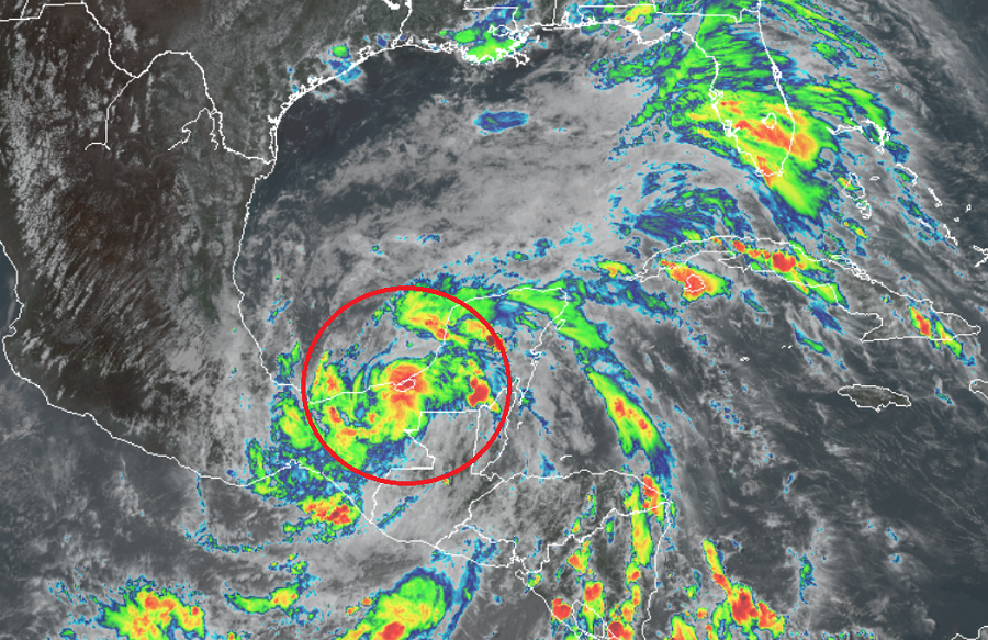
As of the latest update from the National Hurricane Center (NHC), the center of Tropical Storm Cristobal was located near latitude 18.3 North and longitude 91.8 West. Cristobal is
moving toward the southeast near 3 mph. Maximum sustained winds are near 50 mph with higher gusts. Tropical-storm-force winds extend outward up to 60 miles from the center. The estimated minimum central pressure is 995 mb or 29.39 inches.
The NHC believes slow weakening will occur while the cyclone moves over land, and Cristobal will likely weaken back down to a tropical depression by Thursday evening. However, as the storm system reemerges over the water in the Gulf of Mexico and Bay of Campeche, re-strengthening is expected to begin on Friday. Cristobal should turn north-northeast and north on Thursday and Friday, arriving in the middle of the Gulf of Mexico by Saturday. Where it goes from there remains in question.
Most computer forecast guidance suggests the storm will advance to the central Gulf Coast, although landfalls as far west as Texas or as far east as Florida cannot yet be ruled out. The official forecast track from the National Hurricane Center brings it close to the Louisiana coast by Sunday afternoon, but that could change. People throughout the entire Gulf coast should monitor the storm and make sure they have a hurricane action plan in order before a storm threat materiailzes for their area.
With impacts to the United States possible in the coming days, the National Hurricane Center recommends that people develop a written action plan, consider helping neighbors in their planning process, make sure their homes are strengthened prior to being threatened by a tropical system, make sure insurance is in-order, stock up on essential supplies, develop an evacuation plan, and ultimately identify and determine any risks you may face from a storm.
Experts with the Tropical Meteorology Project at CSU believe the upcoming hurricane season will be a particularly busy one with increased chances of a landfalling tropical system compared to typical seasons. NOAA also unveiled their seasonal outlook in May, showing an active season with an above normal volume of storms expected in the Atlantic basin. The Atlantic Hurricane season runs from today through November 30, 2020.
