Tropical Storm Cristobal weakened to tropical depression status, but will continue to bring numerous weather hazards to areas of North America that rarely see tropical cyclones: the Upper Midwest and Central Canada.
In their final update on Tropical Depression Cristobal, the National Hurricane Center says Cristobal was located near latitude 32.5 North, longitude 91.8 West; it is moving toward the northwest near 15 mph. Maximum sustained winds are near 35mph with higher gusts while the estimated minimum central pressure based on surface observations is 995 mb or 29.39 inches.
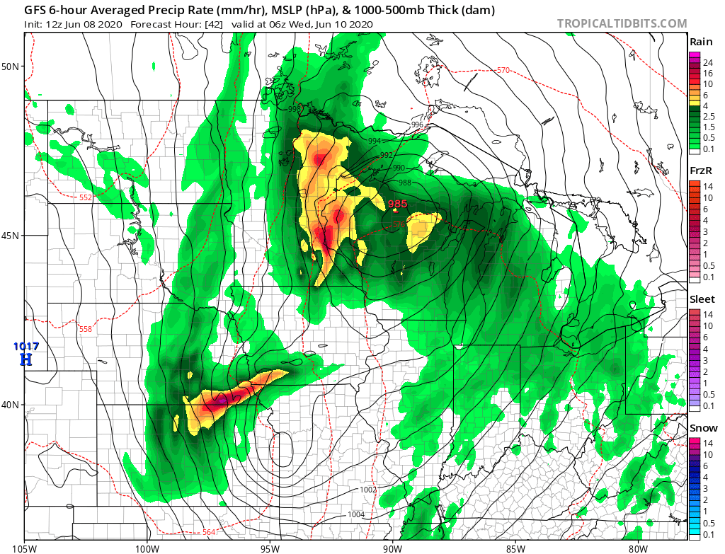
While Cristobal is losing tropical cyclone characteristics, it’ll be picking-up extratropical low characteristics and strengthen as it moves north. Cristobal will become an extratropical low by tomorrow night or Wednesday morning, eventually becoming a post-tropical storm as it whirls about in central Canada by Thursday. Before getting to Canada on Thursday, it’ll turn toward the north tonight, followed by a faster north-north east motion tomorrow. On the forecast track, the center of Cristobal should move through northeastern Louisiana today, through Arkansas and eastern Missouri tonight and Tuesday, and reach Wisconsin and the western Great Lakes by Wednesday.
While gusty winds and flooding rains will head north, conditions will improve along the U.S. Gulf Coast. Gusty winds are expected to continue during the next few hours over portions of the northern Gulf coast from southeastern Louisiana to the western Florida Panhandle. Gusty winds could also occur Tuesday night and Wednesday over portions of the Midwest and western Great Lakes as Cristobal becomes an extratropical low.

Cristobal is expected to produce storm total rainfall accumulations of 5-10″ across portions of the central and eastern Gulf Coast into the Lower Mississippi Valley, with isolated amounts to 15″. Rainfall totals of 2-4″ inches with local amounts to 6″ are expected across portions of the Mid to Upper Mississippi Valley and Northern Plains near and in advance of Cristobal. This rainfall has led to flash flooding and forecast isolated significant river flooding across portions of the central Gulf Coast into the Lower Mississippi Valley. Smaller streams across southeast Louisiana and southern Mississippi have begun to rise and are forecast to crest mid week. New and renewed significant river flooding is possible across the Mid and Upper Mississippi Valley and residents in this area should be prepared to move to higher ground before serious flooding occurs.
An ongoing threat of isolated tornadoes will continue today. Tornadoes are possible today and tonight across Mississippi, Alabama, southeastern Louisiana, eastern Arkansas, western Tennessee, and southeastern Missouri.
While Cristobal is well inland, swells generated by it are still affecting portions of the northern and eastern Gulf coast, and are likely causing life-threatening surf and rip current conditions. These swells are expected to gradually subside throughout the day. Until seas are back to normal, everyone is urged to avoid swimming in the Gulf of Mexico due to those hazards.
