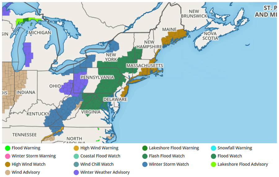
A powerful frontal system will bring damaging winds along the east coast from New Jersey to Maine on Christmas Eve; flooding rains and accumulating snow are also possible for the northeast. With the potent storm about 24 hours away from impact, the National Weather Service has issued High Wind Watches and Warnings, Flash Flood and Flood Watches, Winter Storm Watches, and Winter Weather Advisories for the region.
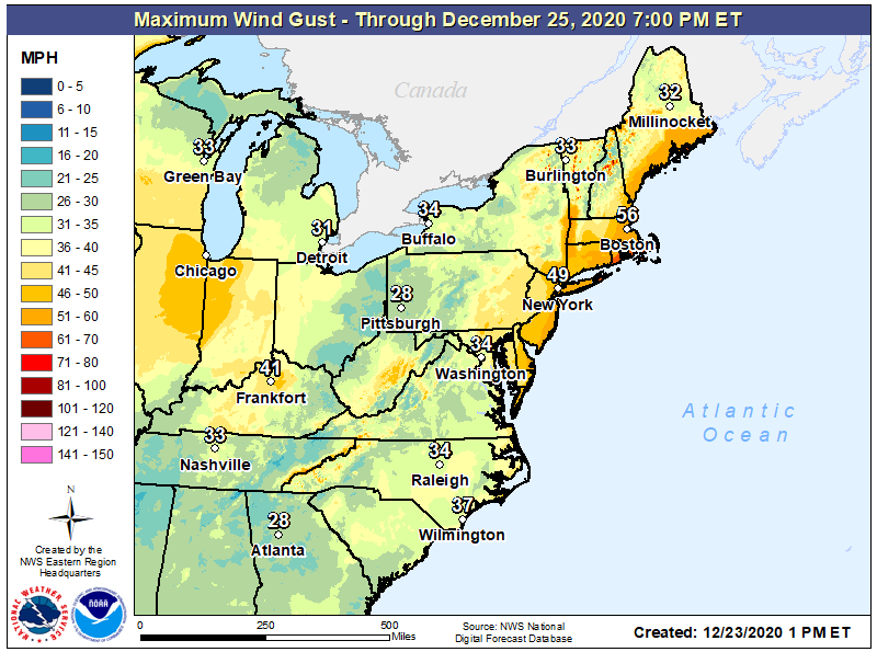
Of the threats impacting the region, strong to severe winds appear to be the most severe. Areas near and south and east of I-95 from southern New Jersey to eastern Maine could see wind gusts over 60 mph at times as the frontal system approaches late Christmas Eve night. Winds will be sustained 20-30 mph for a period of time and these sustained winds and higher gusts will be strong enough to create some damage and knock-out power to many. Those in the northeast, especially those under High Wind Watches, should prepare for the possibility of being in the dark for Christmas Day.
Beyond strong winds, heavy rain will also impact the region. Thanks to strong but mild southerly winds ahead of the frontal passage, rain will fall all the way north to the U.S. / Canadian border. 1-2″+ of rain is expected, which could create isolated flood issues. Combined with snowmelt from significant snow pack from the last winter storm, some flooding problems could be made worse across portions of Pennsylvania, New York, Massachusetts, and Vermont.
In addition to heavy rain and strong winds, there’s also a risk of damaging thunderstorms on the East Coast. These thunderstorms may mix down even stronger winds to the surface, creating more damage risks. On Christmas Eve and into early Christmas morning, people should remain weather aware and take immediate action should a storm-related warning be issued for their area.
After the front passes on Christmas morning, precipitation will change from rain to snow across northern areas. While areas down-wind of the Great Lakes and northern New England could see accumulating snow, no accumulations are expected near the I-95 corridor.
