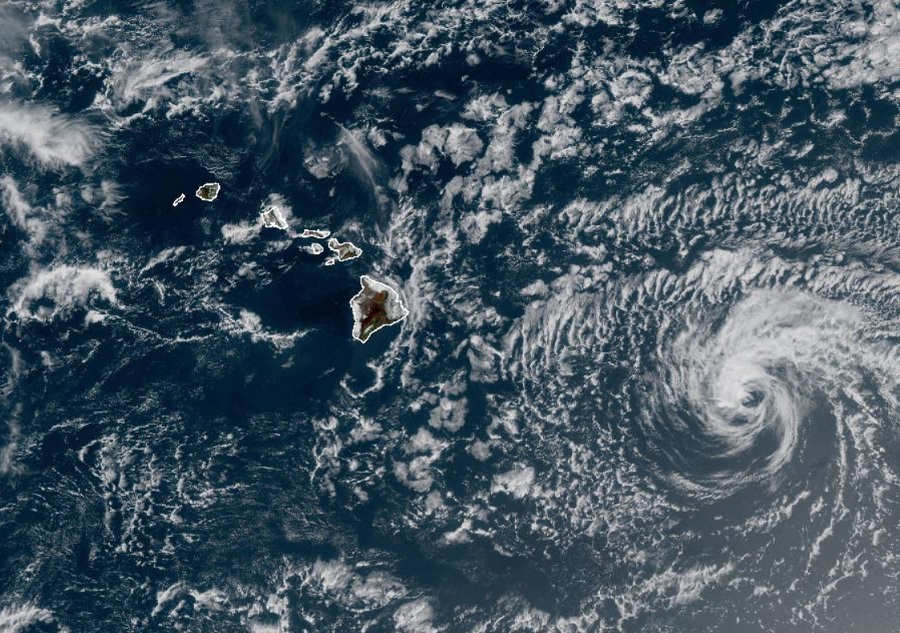
Darby, once a major hurricane, is now merely a tropical storm and continues to rapidly disintegrate in the hostile environment east of the Hawaiian Islands. While that tropical cyclone continues to fall apart, an unrelated swell event is due to impact south facing shores of the islands with significant wave action.
Darby lost its deep convection overnight as it entered an area hostile to tropical cyclones. A combination of strong shear blowing it apart, an injection of dry air helping to dry it out, and colder sea surface temperatures which are cutting its energy source off are all contributing to the rapid disintegration and decay of the storm. In fact, Darby is not expected to be classified as a tropical cyclone much longer.
Believe it or not, this was once a mighty Major Hurricane. Now, it’s a swirl of clouds with little convection. #Darby #HIwx pic.twitter.com/Cnp2PnLx17
— the Weatherboy (@theWeatherboy) July 15, 2022

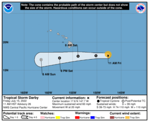
According to the latest forecast track from the Central Pacific Hurricane Center in Honolulu, Hawaii, Darby is forecast to travel south of the Big Island of Hawaii tomorrow. In the last update from the CPHC, Darby was located about 505 miles east-southeast of Hilo and about 710 miles east-south-east of Honolulu and was headed to the west at about 20 mph. Winds are down to 60 mph and further weakening is expected. Based on the CPHC forecast, the center of Darby, or its remnant, will travel south of the
Big Island on Saturday and dissipate well south and west of Oahu, home to Honolulu, by Sunday.
While Darby is falling apart and won’t impact Hawaii head-on as a tropical cyclone, there will be some impacts felt across the state. Large swells generated by Darby are expected to affect portions of the Hawaiian Islands over the weekend. These swells are likely to produce hazardous surf and dangerous rip current conditions. Darby’s lingering plume of moisture is also expected to produce localized storm total rainfall of up to 2-4″ along portions of mainly windward Big Island and windward Maui. These rains may cause nuisance flooding especially in low-lying and poor drainage areas.

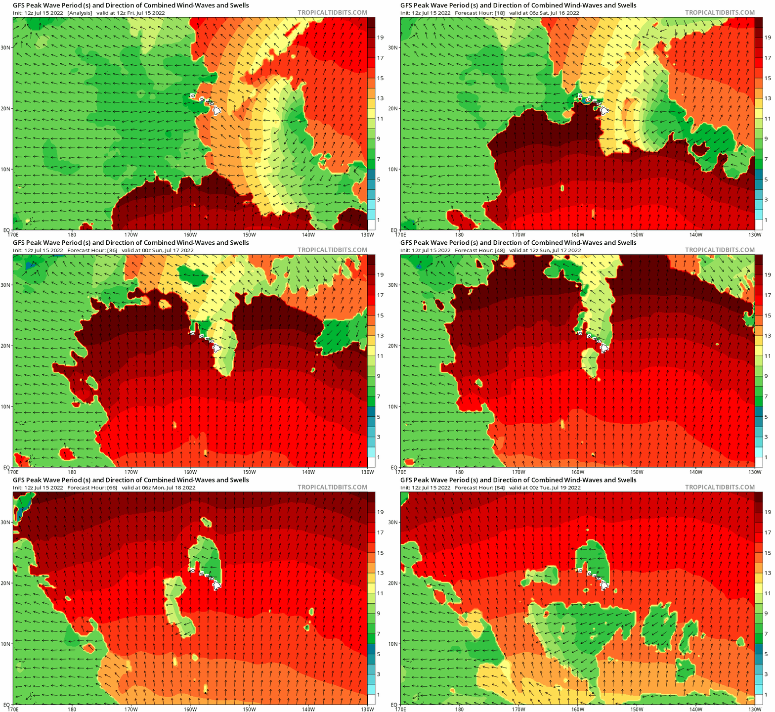
In addition to Darby, Hawaii is also bracing for impacts from a swell originating in the Southern Hemisphere completely unrelated to the tropical cyclone. surface high pressure system will remain far north of the islands through early next week. In the near-term, the trades winds are expected to strengthen as Darby moves closer to Hawaii. Combined seas will be elevated and rough due to a combination of local wind waves, and large south and east swells. While that is going on, what meteorologists at the National Weather Service in Honolulu call the “largest south swell in years”, a swell event is anticipated this weekend with surf heights expected to reach High Surf Warning threshold of 15 feet along south facing shores around Saturday night. Forerunners should begin to arrive tonight and surf will be building all day Saturday especially during the afternoon and evening. This swell should peak Saturday night into Sunday at High Surf Warning levels. This swell should slowly subside through the first half of next week.
Surf along east facing shores will remain elevated and rough into early next week. Swells generated by Darby are expected to add to the mix, with the longer period energy arriving tonight, and likely peaking on Saturday. This swell will mainly impact east facing shores of the Big Island, where a High Surf Advisory is expected this weekend.
Due to the exceptional swell, Hawaii County is closing many county beach parks along the southern side of the Big Island due to hazards associated with this unfolding event. People should avoid these beaches –including experienced swimmers and surfers who could become injured, perhaps fatally, in this swell event.