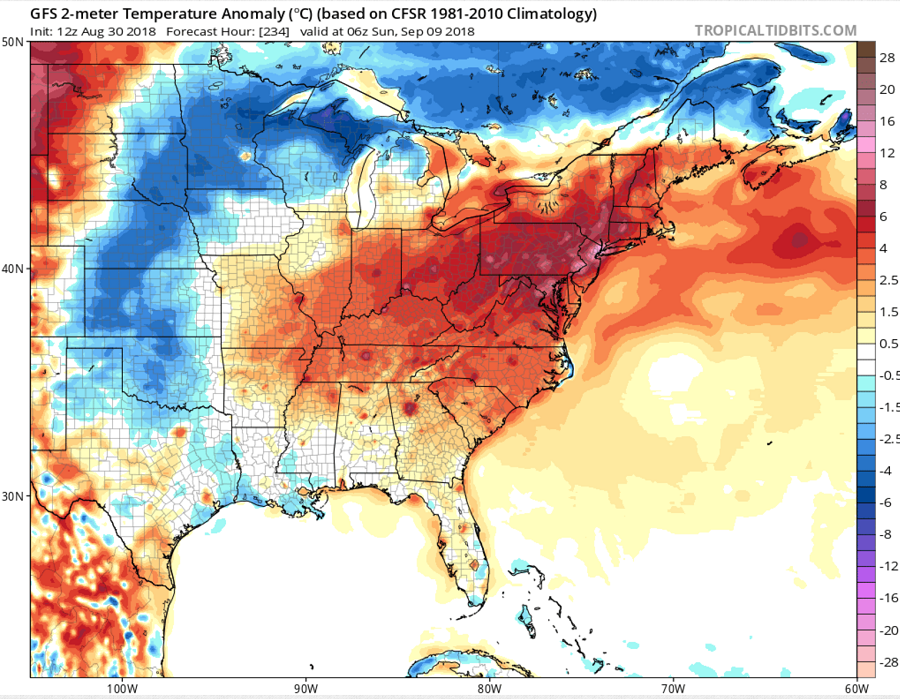
Those hoping to have a longer summer in the eastern U.S. will get their wish as the weather pattern evolves to one that supports more excessive heat and humidity into early September. Based on global forecast model guidance, confidence is high that above normal temperatures will remain over the region for early September, with the most hot and humid conditions setting-up in the heavily populated I-95 corridor between Washington, DC and Boston, MA next week.
In the short term, conditions will be unsettled in the Mid Atlantic prior to the blast of heat and humidity. Chances for showers and a few thunderstorms will exist during the afternoon and evening hours over the next several days. A front will drop to around Virginia on Friday, bringing greater chances of shower and storm activity then to the DelMarVa and southern New Jersey. With that front dropping south, high pressure will be to the north/northeast this weekend, circulating humid air into the northeast. A few shortwaves moving across the area will again bring the chance for scattered storms into next week.
Before the heat blast hits next week, temperatures for Friday and Saturday are expected to be slightly below normal as the high to the north circulates cooler maritime air into the region. The airmass will moderate Sunday and into next week as the upper high begins to strengthen again. Highs will climb again in response to this high, with highs in the upper 80’s rising into the low to mid 90’s by the middle of next week. Combined with high humidity values, the first 10 days of September may feel more like what one would expect during the first 10 days of August.
With school starting in this region at the same time as the arrival of the heat wave, un-air conditioned classrooms may be very uncomfortable for teachers and students. As with other September heat waves, it may be possible that schools and/or their extracurricular activities will be cancelled due to the high heat and humidity.
