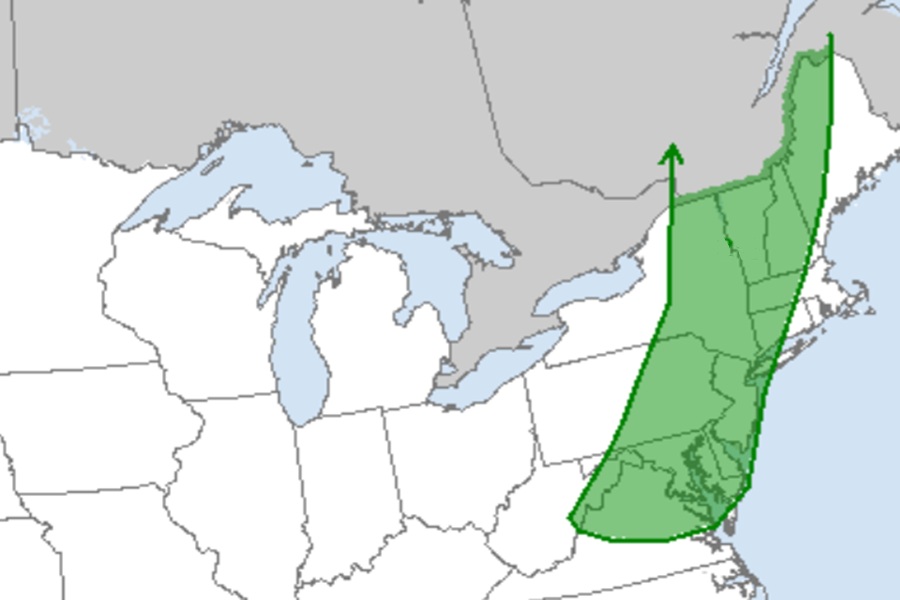
The National Weather Service’s Storm Prediction Center (SPC) is warning people in the northeast that there is an elevated threat of tornadic thunderstorms tomorrow with a severe weather outbreak likely. Strong to potentially severe thunderstorms are forecast on Thursday from parts of New England into the Mid Atlantic and Carolinas.
According to the SPC, a seasonably deep mid/upper-level trough is forecast to move from the lower Great Lakes region into the Northeast and Mid Atlantic on Thursday. A surface low will move across parts of Quebec during the day and evening, as a trailing cold front moves across parts of New England, the Mid Atlantic, and the Southeast. Meanwhile, an upstream midlevel shortwave trough will move across parts of northern Minnesota into Wisconsin and upper Michigan by evening. An amplified mid/upper-level trough will move gradually eastward across the western US, as an upper-level ridge initially over the southern Rockies begins to break down and shift eastward. In response to this trough, a surface low will gradually deepen across the northern High Plains.
Relatively rich low-level moisture will stream northward ahead of the front approaching New England and the Mid Atlantic during the day on Thursday. Moderate buoyancy may develop as far north as northern New York and Vermont, with pockets of stronger heating and atmospheric destabilization farther south into the Mid Atlantic and Southeast.
The strongest deep-layer flow and shear is still expected from Pennsylvania and New Jersey northward into New England, where wind profiles will be conditionally supportive of supercells and organized bowing segments.
“Damaging winds and perhaps a tornado could accompany the strongest storms in this area,” warns the SPC.
Not everyone will see a severe thunderstorm and most people won’t see a tornado; however, the threat will be there and it will be elevated above normal during the day and early evening on Thursday.
Farther south into the southern Mid Atlantic and Carolinas, deep-layer flow will be somewhat unidirectional and weaker, but still sufficient for some organized convection. Clusters capable of producing scattered wind damage will be possible, especially in areas where stronger diurnal heating and atmospheric destabilization occurs.
