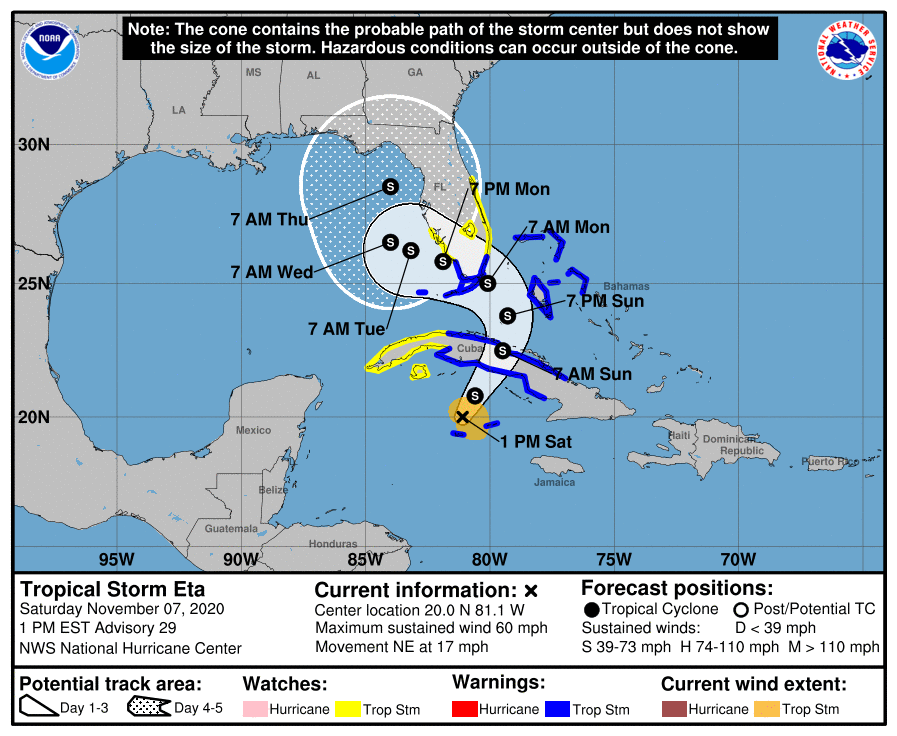
An Air Force Reserve Hurricane Hunter aircraft investigating Eta has found that it has gained additional strength, reaching Tropical Storm status once again. A variety of watches and warnings are up for Cuba, the Bahamas, and Florida, where an eventual rendezvous with the tropical cyclone is expected this weekend.
Currently, Tropical Storm Eta is located about 50 miles north of Grand Cayman and about 230 miles west-southwest of Camaguey, Cuba. With maximum sustained winds now up to 60 mph with higher gusts, the storm is moving to the northeast at 17 mph. The minimum central pressure is 994 mb or 29.36 inches.
Ahead of the storm, many areas are already under watches and warnings and the National Hurricane Center says more will be issued later today.

Right now, a Tropical Storm Warning is in effect for the Cayman Islands, the Cuban provinces of Camaguey, Ciego de Avila, Sancti Spiritus, Villa Clara, Cienfuegos, and Matanzas, the Northwestern Bahamas, including the Abacos, Andros Island, Berry Islands, Bimini, Eleuthera, Grand Bahama Island, and New Providence, for the Florida coast from Golden Beach to Chokoloskee, including Florida Bay, and for the Florida Keys from Ocean Reef to the Dry Tortugas. A Tropical Storm Warning means that tropical storm conditions are expected somewhere within the warning area within 36 hours.
A Tropical Storm Watch is also in effect for the Cuban provinces of La Habana, Artemisa, Mayabeque, Pinar del Rio, and the Isle of Youth, the Florida east coast north of Golden Beach to the Brevard/Volusia county line, for Lake Okeechobee, and for the Florida west coast north of Chokoloskee to Englewood. A Tropical Storm Watch means that tropical storm conditions are
possible within the watch area, generally within 48 hours.
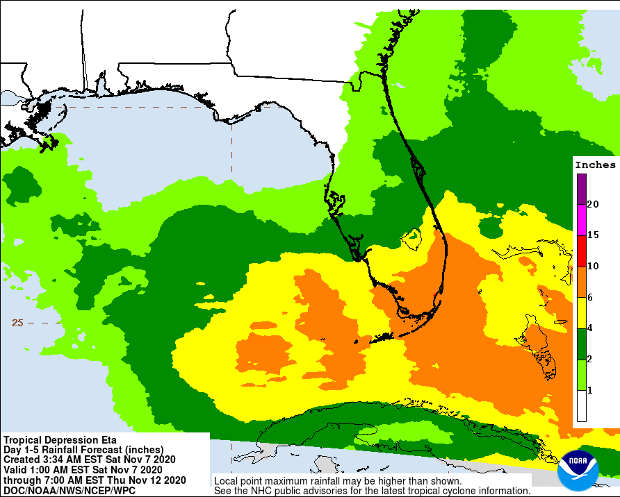
Heavy rainfall will continue across the Cayman Islands, portions of Cuba and Jamaica, and will spread north into the Bahamas and southern Florida. This rain may result in significant, life-threatening flash flooding and river flooding in Cuba. Flash and urban flooding will also be possible for the Cayman Islands, Jamaica, the Bahamas and southern Florida. An additional 2-4″ is expected in Jamaica with isolated maximum storm totals of 15″. In the Cayman Islands and portions of Cuba, an additional 5-10″ of rain is possible with isolated storm totals of 25″. In the Bahamas and portions of the central and southern Florida Peninsula, including the Keys, 5-10″ of rain is expected with isolated maximum totals of 15″.
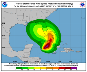
Tropical storm conditions are expected today and Sunday in portions of the Cayman Islands, Cuba, and the northwestern Bahamas, where a Tropical Storm Warning is in effect. Tropical storm conditions are expected by late Sunday in the Florida Keys and along portions of the southeast Florida coast, where a Tropical Storm Warning is in effect. Tropical storm conditions are possible elsewhere in portions of southern and central Florida beginning Sunday night, where a Tropical Storm Watch is in effect.
The National Hurricane Center (NHC) says some additional strengthening is expected through Sunday night. While the NHC official forecast keeps Eta at tropical storm strength through Tuesday, there are computer forecast models suggesting Eta will intensify further to a hurricane. Because of this, people in Tropical Storm Warning areas should be prepared for the possibility that hurricane force winds or wind gusts could be possible if Eta gains additional strength.

Whether or not Eta is a hurricane or tropical storm, a dangerous storm surge will raise water levels by as much as 2 to 4 feet above normal tide levels along the coast of Cuba near and to the east of where the center makes landfall. Near the coast, the surge will be accompanied by large and destructive waves. The combination of a storm surge and the tide will cause normally dry areas near the coast to be flooded by rising waters moving inland from the shoreline. The water could reach up to 3′ at the Florida coast if the peak surge occurs at the time of high tide. The deepest water will occur along the immediate coast in areas of onshore winds, where the surge will be accompanied by large and dangerous waves. Surge-related flooding depends on the relative timing of the surge and the tidal cycle, and can vary greatly over short distances.
Isolated tornadoes are also possible in and around the path of Eta in the coming days. The best chance for tornadoes and waterspouts is over western and central Cuba, Florida south of I-4, and the Florida Keys. Tornadoes or waterspouts may rapidly form with little warning.