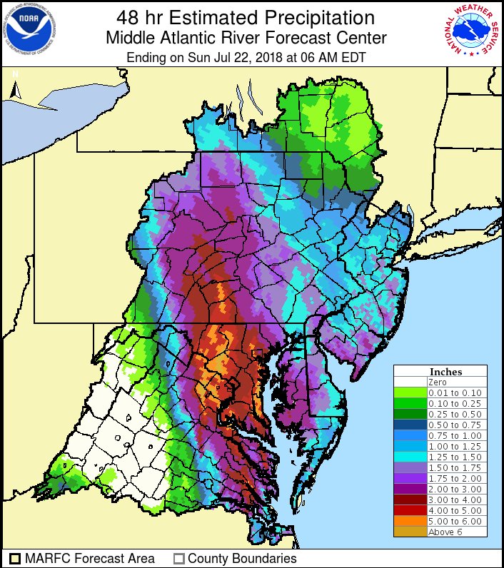
An unusual July coastal storm brought extreme amounts of rain to portions of the Mid Atlantic yesterday and earlier today, and while that storm is wrapping up, a very wet pattern will linger setting the stage for more flooding rains in the coming days. The National Weather Service reports widespread amounts of 2-6″ fell from the coastal storm, with several reports of over 7″. 9.11″ was measured in Storck, Virginia, in Stafford County. Unfortunately for the flood-weary, more flooding rains are expected as several impulses soak the Eastern United States in the coming days.
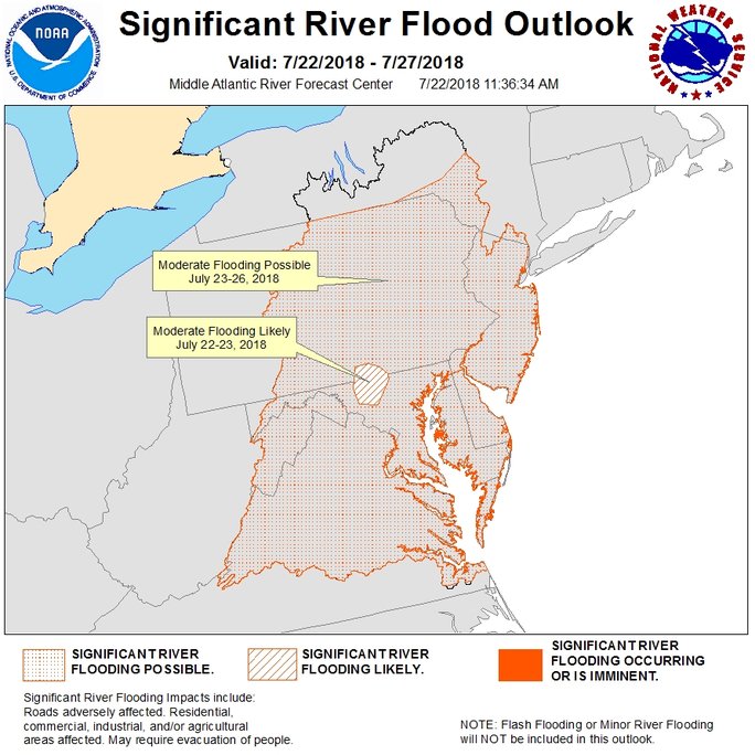
The Mid Atlantic River Forecast Center of the National Weather Service has illustrated where the worst flood threats are in their latest outlook map. Almost the entire area that makes up the Mid Atlantic River Forecast area is under threat of flooding conditions. In some cases, the Mid Atlantic River Forecast Center believes “significant river flooding likely” in portions of south central Pennsylvania and central Maryland. Heavy showers and storms rotating around the weakening coastal storm will persist over portions of the northeast today, although they’ll be scattered in nature. The renewed threat of heavy rain today has prompted the National Weather Service to issue a fresh batch of flood advisories for portions of the Mid Atlantic.
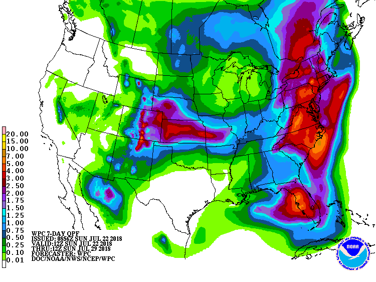
More rain is likely over at least the next 7 days. A deep mid level trough is forecast to be located from the central Great Lakes to Florida on Monday morning, with a ridge over the western North Atlantic. The general pattern should remain in place through Wednesday, with the ridge expected to retreat and the trough anticipated to lift northeastward on Thursday. With this set-up, the expected weather pattern will maintain a deep southerly flow of moist air into and over much of the East Coast on Monday, Tuesday, and Wednesday. There is the potential for showers and thunderstorms each day in most eastern states, especially in the afternoon and evening hours. The abundant moisture will result in locally heavy rainfall. As the ground becomes increasingly saturated, the possibility of flooding along small streams and creeks, and in areas of poor drainage will increase. There is also the likelihood of showers and thunderstorms from Wednesday night into Thursday in much of the East as the mid level trough approaches and passes overhead. As with the previous systems, there will be an ongoing threat for heavy rain and isolated flooding concerns. Beyond flood threats, the very humid air will likely result in a relatively narrow diurnal temperature range from Monday through Thursday. Daytime highs should be in the upper 70s to the middle 80s, with overnight lows ranging mostly from the upper 60s to the middle
70s.