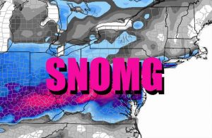
 With internet rumor and speculation running rampant on the chance of snow on Friday, we thought we’d clarify the situation with some facts. In a region in a winter that’s lacked snow, it’s easy to get a lot of attention over a lot of nothing.
At breakfast time on Friday, a 500mb low should be located in far eastern Ontario with a vorticity maximum swinging through to the south across the Appalachians and adjacent Mid Atlantic region. With fairly steep lapse rates on top of cold surface temperatures, light snow flurries could break-out over portions of New York, Pennsylvania, Maryland, Delaware, and New Jersey. However, with available atmospheric moisture at a minimum and surface temperates near or above freezing, any accumulations will be unlikely.
The chance of accumulating snow is so low that the National Weather Service’s Mount Holly, New Jersey office, which is responsible for the territory that includes eastern Pennsylvania and Philadelphia, much of New Jersey, and Delaware, only has the probability of precipitation in the 20-40% range.
While some passing flurries are possible, the bigger news story will be the wind this next system brings. While winds won’t be as serious as they were early Thursday morning, 30-40mph gusts are possible by Friday afternoon as another round of substantial cold air enters the northeast. By Friday night, skies are expected to rapidly clear, with decreasing winds. With clearing skies and fading winds, radiational cooling will occur with temperatures dropping down to very cold levels considering just how mild it’s been. Single digit readings are possible across the southern Poconos with temperatures in the low 20’s possible even near the coast.
More bad news for snow-lovers in this region: at this time, we do not see any solid threats of significant winter storms in the Northeast or Mid Atlantic over the next 2 weeks.