Tropical Depression #8 is forecast by the National Hurricane Center (NHC) to strengthen into the next named storm of the 2020 Atlantic Hurricane season; when that happens, it’ll be called Tropical Storm Hanna.
With the expectation that Hanna will be soon here, a Tropical Storm Warning is now in effect along the Texas coast from Port Mansfield to San Luis Pass. A Tropical Storm Watch is in effect for San Luis Pass to High Island, Texas. A Tropical Storm Warning means that tropical storm conditions are expected somewhere within the warning area within 36 hours. A Tropical Storm Watch means that tropical storm conditions are possible within the watch area, generally within 48 hours.
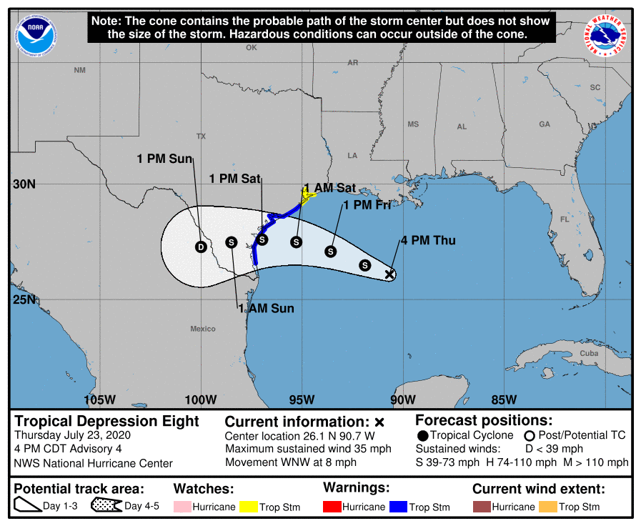
In the latest advisory from the NHC, Tropical Depression #8 was located near latitude 26.1 North, longitude 90.7 West. The depression is moving toward the west-northwest near 8 mph and a west-northwestward to westward motion is expected during the next couple of days. On the forecast track, the center of the depression is expected to move across the northwestern Gulf of Mexico tonight and Friday and make landfall along the Texas coast on Saturday.
Maximum sustained winds are near 35 mph now with higher gusts. Strengthening is expected during the next 48 hours, and the depression is expected to become a tropical storm tonight.
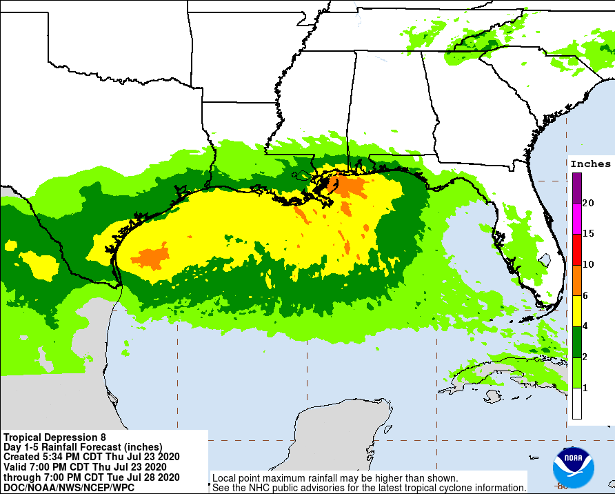
While Hanna won’t be a particularly intense storm, it will produce plenty of heavy rain that could lead to significant flood problems. Widespread 3-5″ amounts are expected with some isolated maximum totals of 10″ possible through Monday along the U.S. Gulf Coast from Louisiana to south Texas and inland to the Mexican states of Coahuila, Nuevo Leon, and northern Tamaulipas. This rain may result in life threatening flash flooding, rapid rises on small streams, and isolated minor-to-moderate river flooding.
Swells generated by the tropical cyclone are expected to increase and affect much of the Texas and Louisiana coasts in a day or two. These swells are likely to cause life-threatening surf and rip current conditions. Even experienced swimmers and surfers are urged to avoid the Gulf of Mexico until the storm has long passed.
