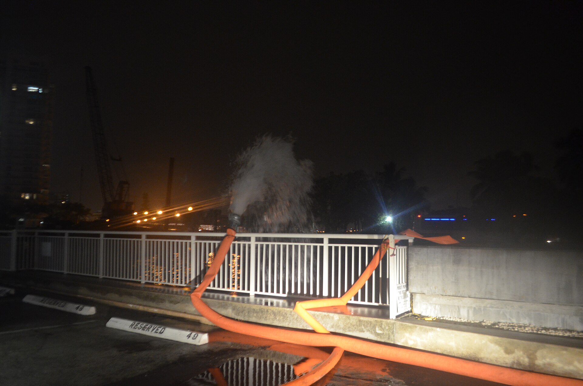
Bands of heavy rain and thunderstorms were expected to soak South Florida on Sunday and Monday, raising the threat of flash flooding in neighborhoods still recovering from what a University of Miami researcher called the highest king tide ever recorded there.
The National Weather Service in Miami issued a flood watch for all of Palm Beach, Broward and Miami-Dade counties from 10 a.m. EST Sunday through Monday afternoon. The weather service office in Melbourne issued a similar watch for Brevard, Indian River, St. Lucie and Martin counties.
“Uncertainty is high regarding exactly where the highest rain amounts will fall,” the Miami office said in its watch. “However, scattered locations across the east coast may pick up 3 to 5 inches of rain through Monday. Isolated spots may see accumulations as high as 5 to 7 inches. These amounts may fall over a window of a few hours.”
The office added: “Expected impacts could be greater than forecast if the heaviest rainfall occurs near the coast during times of high tide.”
Rain was already falling early Sunday. At 7:07 a.m. EST, the weather service issued a flood advisory for southern Broward County, saying radar showed 1 to 2 inches of rain had fallen and minor flooding was underway or about to begin in places including Davie, Plantation, Sunrise, Weston and Cooper City.
Here we go again!
— the Weatherboy (@theWeatherboy) November 1, 2026
Why the Rain is Lingering
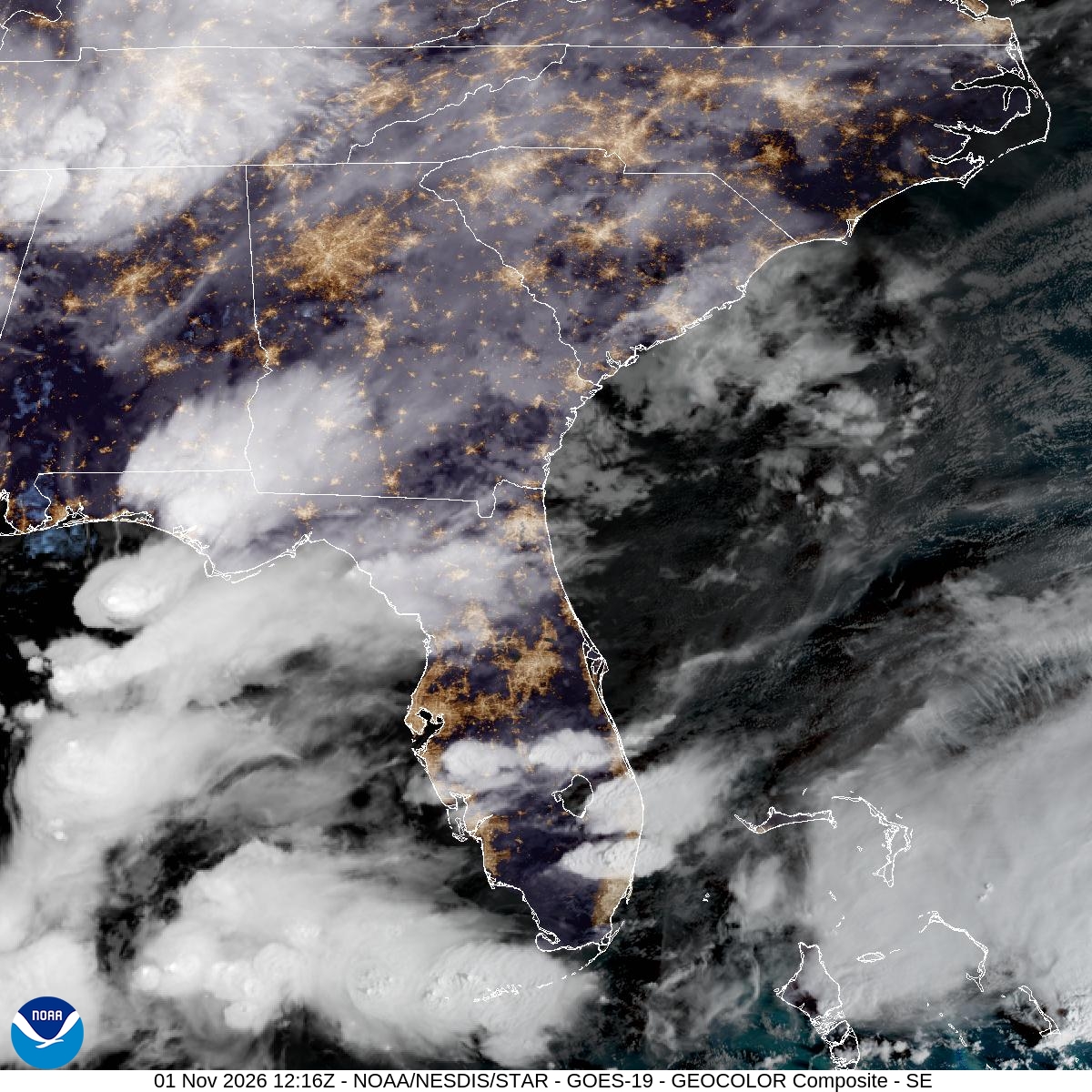
Forecasters said an upper-level low moving over Florida through Monday would add moisture and support for showers and storms. “Strong low-level easterly flow will result in bands of repeated rainfall for isolated to scattered locations,” the Miami office said. “Showers and storms are expected to be a bit more widespread with higher rain rates than the past few days.”
The Weather Prediction Center, part of the National Weather Service, placed the Interstate 95 corridor from the Georgia line south through Miami under a Slight Risk, level 2 of 4, for excessive rainfall on Sunday. It forecast a widespread 1 to 3 inches of rain over much of the peninsula and said this would be “the latest in a string of days that has caused areas of heavy rainfall over the east coast.”
The Miami office said Broward County probably had the greatest chance for the highest totals on Sunday, with the axis of heavy rain possibly shifting north to Palm Beach County overnight.
The Melbourne office said moisture levels over South and Central Florida were more than 170% of normal. It forecast 1 to 3 inches of rain through Monday, with a 10% chance of 5 to 7 inches.
Coastal Flooding and Dangerous Surf
Coastal flood advisories remained in effect until 7 p.m. Monday for coastal Palm Beach, Broward and Miami-Dade counties, where the weather service warned of minor to moderate flooding of lots, parks and roads. A high surf advisory for Palm Beach and Broward counties called for breaking waves of 5 to 8 feet through Sunday evening, and the risk of dangerous rip currents was high through Monday.
Farther north, the Melbourne office warned of minor coastal flooding along the St. Lucie and Martin county coasts and breakers of 5 to 7 feet. “Please remain out of the ocean!” forecasters wrote.
In the Florida Keys, the weather service in Key West issued a coastal flood advisory through 5 a.m. Monday, warning that “some storm drains will overflow, and some seawalls and docks will be overtopped.” Motorists “should remember that persistent puddles around the times of high tide are almost certain to contain a mix of saltwater,” the advisory said.
The Miami office said tides were near a low point between the full and new moons, but “probabilities of at least reaching low-end moderate flood levels appear too high to let the Coastal Flood Advisory drop.” Water levels are forecast to begin climbing again by midweek ahead of the new moon on Nov. 9, forecasters said.
A Record-Setting King Tide
The rain comes days after a king tide, the highest tides of the year, pushed seawater into streets from Miami to West Palm Beach.
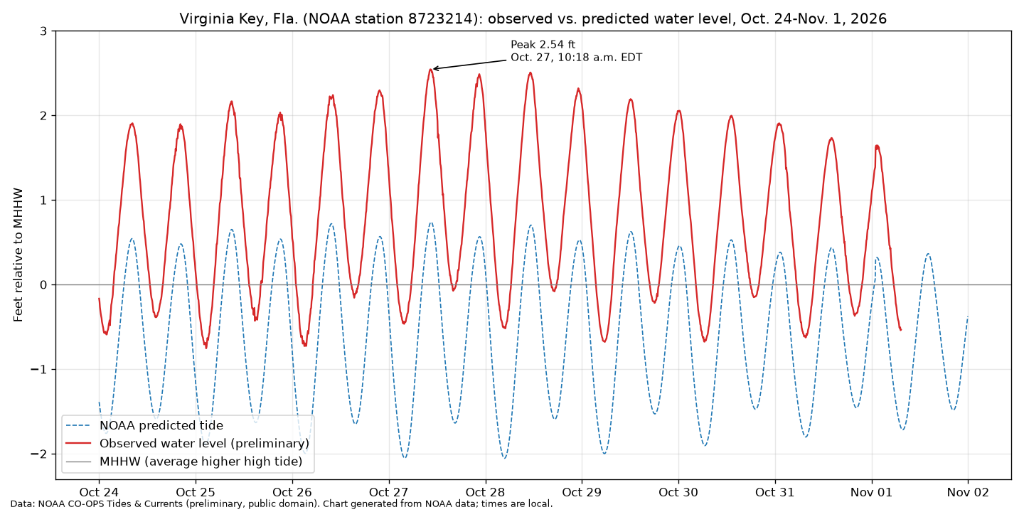
On Tuesday, Oct. 27, water at NOAA’s Virginia Key tide gauge in Biscayne Bay reached 2.54 feet above mean higher high water at 10:18 a.m., according to preliminary NOAA data. Tide tables had predicted about 0.73 feet, The Miami Lookout reported. The level exceeded the weather service’s major flood threshold for the gauge.
The Miami Herald reported that it was the most water recorded at the Virginia Key gauge outside of a hurricane since it was installed in 1994. The top spot belongs to Hurricane Irma in 2017, which brought 3.6 feet, the newspaper reported. Port Everglades’ tide gauge also broke its record, the Herald said.
“This is the highest king tide we’ve ever had. And by ever I mean ever ever, not just since the gauge went in,” Brian McNoldy, a senior research associate at the University of Miami’s Rosenstiel School of Marine and Atmospheric Research, told the Herald. He said a low-pressure system passing by the coast was “bulldozing water onto the coast.”
Fort Lauderdale officials closed the Las Olas Bridge because of flooding, the Herald reported. WSVN-TV reported that seawater breached a seawall and spilled onto Collins Avenue in Miami Beach on Wednesday morning.
Alejandra Garcia, a forecaster with the National Weather Service in Miami, told the Herald that strong onshore winds created a “perfect storm” for coastal flooding. She said that if the ground gets saturated, even scattered showers could worsen standing water. “Never drive through saltwater flooding,” Garcia said, noting that it can damage cars. “We saw a lot of that this time around.”
What Comes Next
The next king tide is forecast for Nov. 6-9, with minor to moderate flooding possible, the Herald reported. “For our upcoming king tide, we’re not expecting it to reach that major flood stage at this point,” Garcia said. Another round is expected Nov. 23-26.
WSVN-TV meteorologists said the disturbance should fade by Wednesday, bringing drier but warmer weather, with highs in the mid- to upper 80s, and that a front could reach South Florida by the end of the week.
Until then, the weather service urged residents to stay alert. “You should monitor later forecasts and be alert for possible Flood Warnings,” the flood watch said. “Those living in areas prone to flooding should be prepared to take action should flooding develop.”
