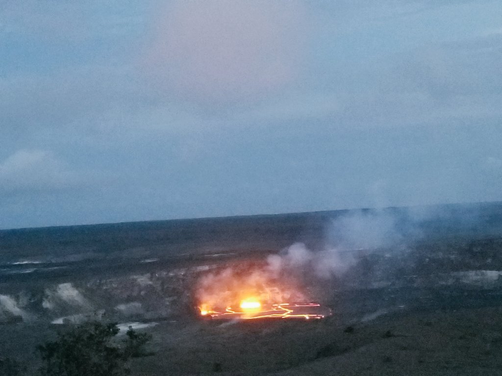
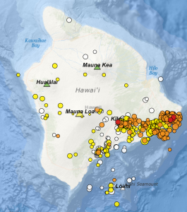
People are on edge in Hawaii after a sudden surge in seismic and volcanic activity there has scientists concerned that a significant eruption event may happen soon; more concerning: this next eruption may occur in the middle of a residential area. More than 800 earthquakes have been measured on Hawaii’s Big Island over the last week, culminating into a day of nearly constant shaking yesterday.
Wednesday’s increase in activity led to the USGS releasing this statement last night: “Elevated rates of seismicity and deformation at Kīlauea Volcano along a section of the lower East Rift Zone east of the Pu’u ‘Ō’ō vent are continuing this evening. This activity is associated with the continued intrusion of magma into the East Rift Zone to locations east of Highway 130. An outbreak of lava from the lower East Rift Zone remains a possible outcome of the continued unrest. At this time it is not possible to say with certainty if or where such an outbreak may occur, but the area downrift (east) of Pu’u ‘Ō’ō remains the most likely location.”
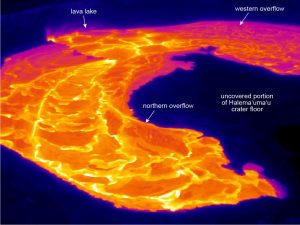
In late April, the Kilauea volcano exhibited increased activity inside Hawaii Volcanoes National Park. Lava activity increased in the Halema’uma’u crater floor, resulting in rising lava lake levels which in turn splattered and spilled to the delight of visitors and scientists at the park. While activity there continues to ebb and flow, there was a dramatic change at the nearby Pu‘u ‘Ō‘ō crater which isn’t accessible by park guests. Starting on the afternoon of Monday, April 30, 2018, magma beneath Pu‘u ‘Ō‘ō drained and triggered the collapse of the crater floor. Within hours, earthquakes began migrating east of Pu‘u ‘Ō‘ō, signaling an intrusion of magma along the middle and lower East Rift Zone. A rift zone is linear zone of fissures along the flanks of a volcano from which lava erupts.
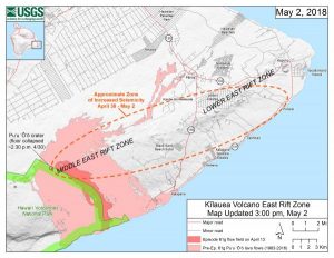
In the case of the East Rift Zone in Hawaii, the area where a new volcanic eruption can form is over a populated area south of Hilo. Well east of Hawaii Volcanoes National Park, this area has several residential communities surrounded by tropical forest. Communities in the Lower East Rift Zone, which include Nanawale Estates, Leilani Estates, and Kapoho could be at greatest risk. However, the USGS cautions that it is impossible to pinpoint where an eruption of lava could occur.
The area at risk is not a complete stranger to volcanic eruptions. In 1955, the Lower East Rift Zone was home to a volcanic event that lasted three months. During that time, 24 separate volcanic vents opened, from which a tremendous amount of lava poured out. Almost 4,000 acres of land were covered in lava as a result of the 1955 event, covering many roads in the region. During that event, lava was blasted as high as 800 feet in the air from those vents.
Prior to the 1955 event, the last lava activity on the east rift zone had been in the vicinity of Makaopuhi Crater, in 1923. Not since 1840 had there been activity in eastern Puna. In 1924, however, a very large number of earthquakes along the east rift zone accompanied the draining of lava from Halemaumau Crater in the caldera and the formation of fault scarps and grabens in eastern Puna. The eastern outbreaks in 1955 closely followed the lines of fissuring and faulting in 1924.
Some scientists with the USGS believe there are some similarities with the activity occurring in this region now to this 1955 event. However, with the science of volcanology still in its infancy, volcanic eruptions can’t yet be forecast with the same precision as weather, even in the short-term.
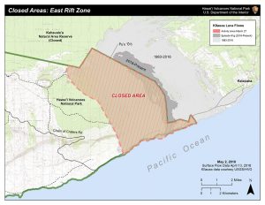
With the threat of a new eruption growing, although not imminent, officials are preparing the region for potential disaster. Yesterday, Hawaii Volcanoes National Park announced the closure of 15,688 acres there due to the possibility of a new eruption and unstable geologic activity in the region. The area extends near Kīlauea Volcano’s Pu‘u ‘Ō‘ō vent to the ocean, including the gravel emergency access road from the eastern gate near Kalapana, to the western gate at the end of Chain of Craters Road, and all land on the makai (ocean) side of the emergency road.
“The recent eruption changes and increased seismicity around the East Rift Zone and Pu‘u ‘Ō‘ō vent may threaten land and the community outside the park. The partial closure in the park is necessary to prevent unsafe travel onto lands under the jurisdiction of Hawai‘i County and to keep people safe,” said Park Superintendent Cindy Orlando. “Most of the park, which is 333,308 acres in size, remains open,” she said.
Due to the possibility of an eruption, Hawaii County Civil Defense is recommending people in the threat region to be prepared. “Prepare and review your emergency plans in case you need to evacuate. Stay informed by listening to local radio stations for Civil Defense updates or call Civil Defense at 808-935-0031,” the team said in an alert to the community.
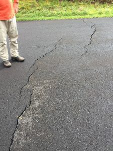
With the magma intrusion beneath the Lower East Rift Zone, cracks are developing as the ground stretches. With cracks impacting roadways too, Hawaii officials have begun to close roads and warm travelers to watch out for deteriorating road conditions and new closures. As of Thursday morning, authorities said that the Pohoiki Road is closed between Highway 130 and Leilani Avenue due to cracks.
The volcanoes in Hawaii pose other threats. While there are no active lava flows into the ocean at this time, when they do form, toxic clouds of hazardous gas can be created when the hot lava interacts with the sea water. Even rain water interacting with lava could become deadly; in February, a tour guide was killed when a rain shower moved over a lava flow, enveloping the guide and his tour group in a hazardous cloud. A large amount of greenhouse gasses are emitted from the volcano, making air quality in the area poor at times. NASA recently used this to test technology used for future air quality forecasts.