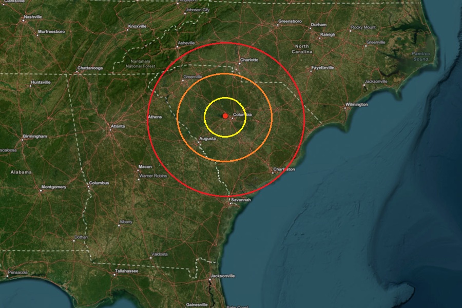
The town of Irmo, which is south and west of Columbia, South Carolina, was rocked by an earthquake today, with hundreds of people reporting having felt it. According to USGS, at 12:17 pm, a magnitude 3.0 earthquake struck the area from a depth of only 0.2 km.
Today’s earthquake was the strongest of 4 to strike the same area in the last 13 days. On February 13, a magnitude 2.8 earthquake struck here; on February 15, a magnitude 2.0 earthquake struck, and on February 16, a magnitude 1.8 earthquake struck.
All of the earthquakes here have been located on the east side of Lake Murray, a 50,000-acre reservoir held back by a dam. If the dam broke from a natural disaster like an earthquake, it would send roughly 650 billion gallons of water into nearby communities. According to Kim Stenson, the Director of the South Carolina Emergency Management Division, said a breach of the dam would subject the nearby Midlands area to catastrophic flooding, with water reaching south of I-20 into the Congaree Swamp.
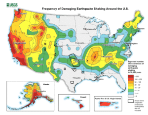
South Carolina has been seismically active this year, with three key areas getting earthquakes in recent weeks: the area west of Columbia, like today’s, an area east of Columbia that has seen a long-term swarm, and an area north and west of Charleston that has seen an uptick in seismic activity lately.
South Carolina is home to the U.S. East Coast’s worst recorded earthquake, a catastrophic event which struck Charleston in 1886. On Sunday night at 11:57 pm, USGS reported a relatively weak magnitude 2.0 earthquake struck near Yacht Cove by Lake Murray outside of the towns of Irmo and Seven Oaks and about 5 miles north and west of downtown Columbia. The earthquake had a depth of 3.6 km. The earthquake was too weak to create any damage or cause any injuries, but a dozen people did report to USGS hearing and/or feeling the earthquake.
According to the South Carolina Emergency Management Division (SCEMD), there are approximately 10-15 earthquakes every year in South Carolina, with most not felt by residents; on average, only 3-5 are felt each year. Most of South Carolina’s earthquakes are located in the Middleton Place-Summerville Seismic Zone. The two most significant historical earthquakes to occur in South Carolina were the 1886 Charleston-Summerville quake and the 1913 Union County quake. The 1886 earthquake in Charleston was the most damaging earthquake to ever occur in the eastern United States; it was also the most destructive earthquake in the U.S. during the 19th century.
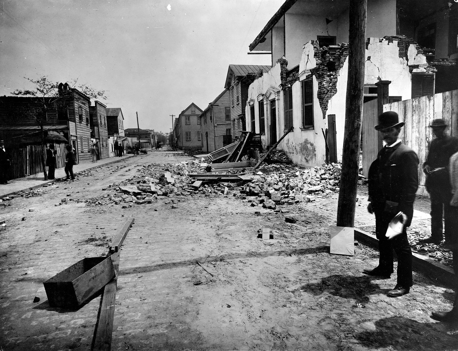
The 1886 earthquake struck at about 9:50 pm on August 31; it was estimated to have been rated a magnitude 6.9 – 7.3 seismic event. The earthquake was felt as far away as Boston, Massachusetts to the north, Chicago, Illinois and Milwaukee, Wisconsin, to the northwest, and New Orleans, Louisiana to the south. The earthquake energy even traveled as far away as Cuba and Bermuda, where some shaking was felt too. The initial earthquake lasted about 45 seconds.
The 1886 Charleston earthquake was responsible for 60 deaths and over $190 million (in 2023 dollars) in damage. The area of major damage extended out 60-100 miles from the epicenter, with some structural damage even reported in central Alabama, Ohio, eastern Kentucky, southern Virginia, and western West Virginia from the initial quake.
A study published in 2008 in the Journal of Geotechnical and Geoenvironmental Engineering hypothesized that if such an earthquake were to strike the region today, it would lead to approximately 900 deaths, 44,000 injuries, and damages in excess of $20 billion in South Carolina alone.
