The National Hurricane Center in Miami, Florida is currently monitoring a possible tropical disturbance that could form around the Gulf of America or the Bay of Campeche in the coming days. Beyond this potential disturbance, the tropics are quiet with no other area in the Atlantic Hurricane Basin being closely monitored for tropical cyclone formation.
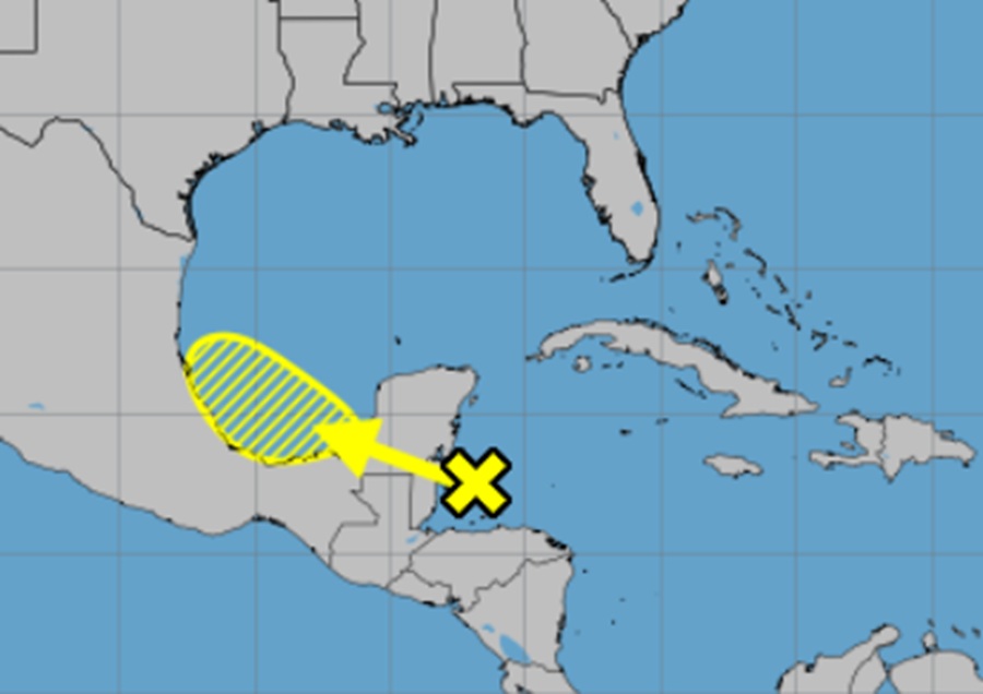
An area of disorganized showers and thunderstorms over the northwestern Caribbean Sea and the adjacent land areas is expected to move west-northwestward into the Bay of Campeche Saturday or Saturday night, where an area of low pressure could form. According to the National Hurricane Center, subsequent development is possible on Sunday or Monday if the system remains offshore of the coast of Mexico.
Regardless of development, locally heavy rains are possible over portions of Belize, Guatemala, and southeastern Mexico during the next few days.
If formation occurs, energy or moisture from the system could make its way to Texas and the rest of the coastline of the Gulf of America. However, the National Hurricane Center puts odds on such a thing happening pretty low for now. According to their latest Tropical Outlook, there’s only a 10% chance of tropical cyclone formation over the next 48 hours and only 20% over the next 7 days.
Elsewhere no tropical cyclone development is expected basin-wide.
The Atlantic Hurricane Season began on June 1 and runs through to November 30.
