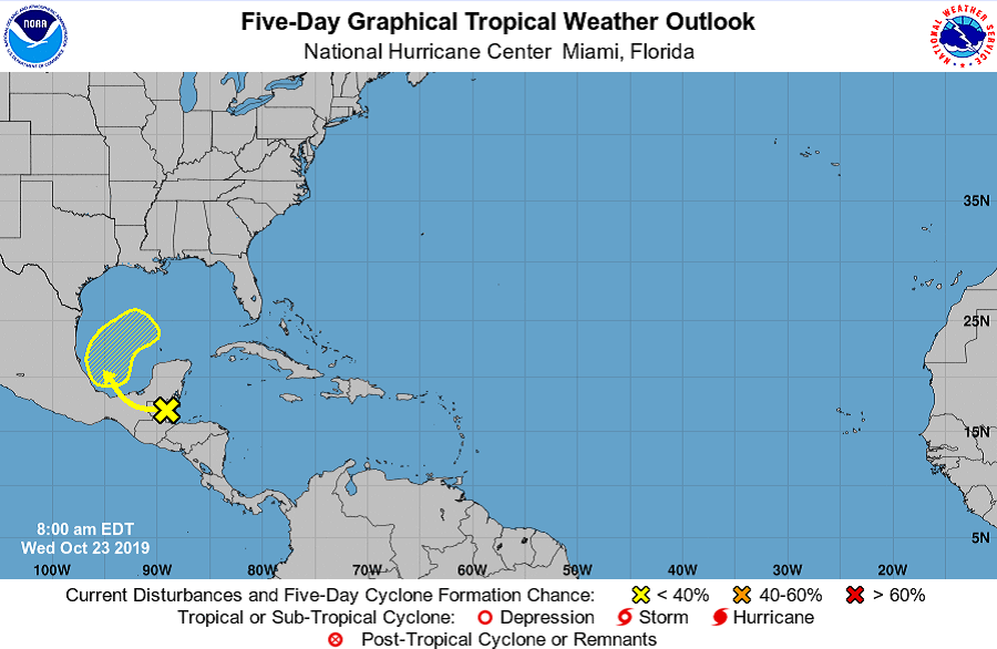
The National Hurricane Center in Miami, Florida is tracking a disturbance destined for the Gulf of Mexico while the Central Pacific Hurricane Center in Honolulu, Hawaii is tracking a disturbance well south of Hawaii’s Big Island. Both only have a low chance of evolving into a tropical cyclone.
The system that could become an issue in the Gulf of Mexico with time is now over Central America. A tropical wave is producing disorganized showers and thunderstorms over the Yucatan Peninsula, Belize, and the adjacent waters of the northwestern Caribbean Sea and the southwestern Gulf of Mexico. According to the National Hurricane Center, this disturbance is forecast to move west-northwestward and emerge over the Bay of Campeche on Thursday, and then move northward and northeastward into the southwestern and central Gulf of Mexico on Friday and Saturday. Some development will be possible on Friday and early Saturday before the system merges with a cold front by early Sunday. For now, the National Hurricane Center believes there’s only a 30% chance that a tropical cyclone will form here over the next five days.
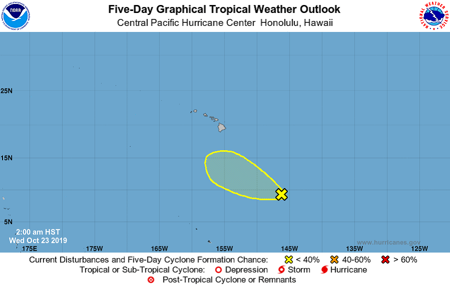
In the Central Pacific Hurricane Basin, meteorologists are monitoring a system well south of Hawaii’s Big Island. An elongated area of low pressure about 950 miles southeast of Hilo, Hawaii, is producing disorganized showers and thunderstorms while moving toward the west-northwest near 10 mph. According to the Central Pacific Hurricane Center, upper-level winds are not expected to be conducive for further development of this system. Because of that upper level sheer, the Central Pacific Hurricane Center believes there’s only a 20% chance of tropical cyclone formation there over the next five days.
Elsewhere in both the Central Pacific and Atlantic Hurricane Basins, there are no other areas being observed for possible tropical cyclone development over the next 5 days.
In addition to the Central Pacific and Atlantic Hurricane Basins being quiet, the Eastern Pacific basin is quiet too. There’s been no Western Hemisphere hurricane activity since Lorenzo in the Atlantic on October 2. The last time that October 3 – 23 had no Western Hemisphere hurricanes was 2007.
