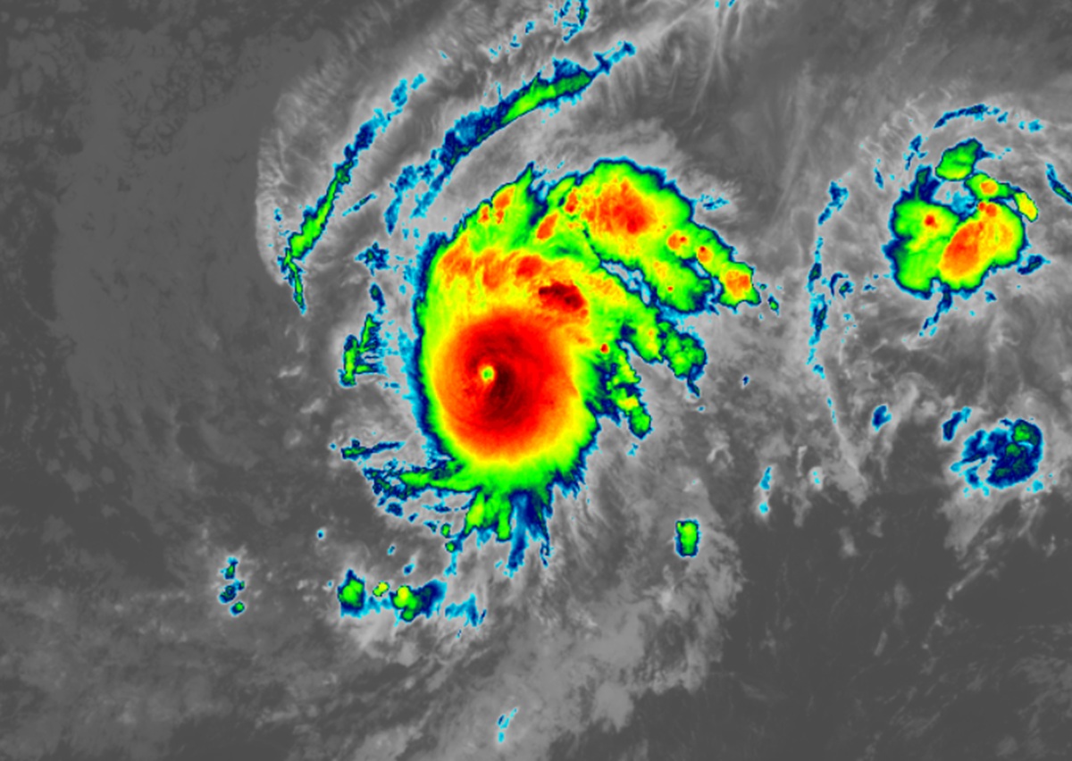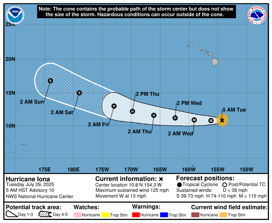
Hurricane Iona has intensified into a major hurricane as it spins about well south of Hawaii. Iona is the first named system of the 2025 Central Pacific Hurricane Season which began on June 1 and runs through to November 30. Fortunately for Hawaii, the storm poses no direct threat to the state with the storm passing to the west well south of the island chain state.
As of the latest advisory from the Central Pacific Hurricane Center and the National Hurricane Center, Major Hurricane Iona was located about 765 miles south-southeast of Honolulu on Oahu in Hawaii. Located at 10.8 N 154.3 W, the storm has maximum sustained winds of 125 mph with higher gusts. With pressure down to 957 mb or 28.26″, the storm is moving due west at 13 mph.
The official forecast has the storm marching west with a gradual increase in forward speed during the next couple of days. Iona is a strong category 3 hurricane on the Saffir-Simpson Hurricane Wind Scale and additional strengthening is forecast tonight, with steady weakening expected to begin by Wednesday as the storm hits cooler waters. It is expected to become a Category 4 hurricane before weakening.

Hurricane-force winds extend outward up to 15 miles from the center and tropical-storm-force winds extend outward up to 70 miles.
Hurricane Iona and nearby Tropical Storm Keli are forecast to pass several hundred miles south of Hawaii over the next couple of days. According to meteorologists at the Honolulu office of the National Weather Service, isolated thunderstorms along the northern periphery of these systems may effect the far southern portion of the offshore waters, and while some short-period southeast swells may reach southern shores of Hawaii, a much larger and unrelated south swell will dominate.
An active period of south swell is due this week. The first in a series of long-period swells will arrive later this afternoon or evening and will build south shore surf to near summertime average levels on Wednesday. Long period forerunners of a much larger swell will overlap the first swell on Wednesday, and the bulk of the swell will peak at around 4 to 5 feet in Hawaiian waters on Thursday, then hold surf heights in excess of the High Surf Advisory threshold through Friday. The swell will gradually decline over the weekend and will be followed by another sizable long period south swell early next week.
East shore surf will trend up over the next few days as strengthening trade winds generate larger wind waves. Surf along east facing shores will rise to seasonal average late Wednesday or Thursday and hold into the weekend, followed by a likely decline early next week.
Flat summer conditions along north facing shores may be interrupted this weekend by a small long period northwest swell from Typhoon Krosa, currently in the western Pacific.
Beyond interacting with and/or adding to swell, Iona and Keli should remain far enough away from Hawaii to not influence the trade winds much or impact fire weather threats for the balance of the week. Nevertheless, the National Weather Service will continue to monitor these conditions and will alert the public should there be any changes to the surf forecast, trade winds, or fire weather conditions.