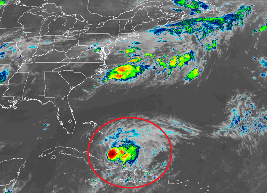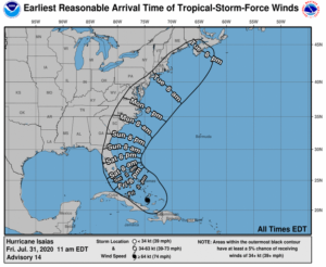
The National Hurricane Center (NHC) in Miami, Florida has started to issue Hurricane Watches for the east coast of Florida; further watches and warnings may be required in time for the entire U.S. East Coast as Hurricane Isaias becomes stronger, larger, and is now more likely to hug and impact the coast than head out to sea. While residents in the Hurricane Watch area should act on their Hurricane Action Plan, residents up the entire East Coast, especially in the Carolinas, Virginia, Delaware, Maryland, New Jersey, New York, Rhode Island, and Massachusetts should make sure their Hurricane Action Plan and basic hurricane plan supplies are in order; it may become necessary to act on those plans this weekend and early next week.

Data from hurricane hunter reconnaissance aircraft indicate that maximum sustained winds are near 75 mph with higher gusts. The NHC says some strengthening is possible today and tonight, and Isaias is expected to remain a hurricane for the next few days.
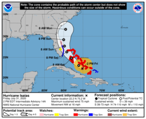
Right now, a Hurricane Warning is in effect for the Northwestern Bahamas including Andros Island, New Providence, Eleuthera, Abacos Islands, Berry Islands, Grand Bahamas Island, and Bimini, the Southeastern Bahamas including the Acklins, Crooked Island, Long Cay, the Inaguas, Mayaguana, and the Ragged Islands, and the Central Bahamas, including Cat Island, the Exumas, Long Island, Rum Cay, and San Salvador.
A Hurricane Watch is now in effect for the Florida east coast north of Deerfield Beach to the Volusia-Brevard County Line.
A Tropical Storm Warning is in effect for the Turks and Caicos Islands, and in Florida around Lake Okeechobee and north of Ocean Reef north to Sebastian Inlet.
Each warning and watch has different meanings. A Hurricane Warning means that hurricane conditions are expected somewhere within the warning area. Preparations to protect life and property should be rushed to completion. A Hurricane Watch means that hurricane conditions are possible within the watch area. A watch is typically issued 48 hours before the anticipated first occurrence of tropical-storm-force winds, conditions that make outside preparations difficult or dangerous. A Tropical Storm Warning means that tropical storm conditions are expected somewhere within the warning area within 36 hours.

Hurricane Isaias is bringing dangerous storm surge, winds, and flooding rains with it; these risks will change as the storm changes intensity, size, and evolves with its future track.
For now, it appears a dangerous storm surge will raise water levels by as much as 3 to 5 feet above normal tide levels in areas of onshore winds in the Bahamas.
Tropical storm wind conditions will continue across portions of the Turks and Caicos this morning. Hurricane conditions in the southeastern Bahamas will spread northwestward into the central and northwestern Bahamas tonight and into Saturday. Tropical storm conditions are expected in the warning area in Florida beginning Saturday. Hurricane conditions are possible in the Hurricane Watch area beginning Saturday night and continuing into Sunday.
Isaias will dump very heavy rain which could lead to life-threatening flash floods. In the Dominican Republic and northern Haiti, 4-8″ is expected with isolated totals near a foot. In the Bahamas, Turks and Caicos, 4-8″ is expected. Cuba will see 1-2″ amounts with isolated maximum totals of 4″. Beyond flash flooding, these rains could also create mudslides over mountainous terrain of the Caribbean and river flooding. Urban and small stream flooding is also expected for the U.S. Virgin Islands and Hispaniola. Later Friday night through Monday, south Florida and east central Florida could see 2-4″ of rain with isolated amounts to 6″. In Florida, these rainfall amounts could result in isolated flash and urban flooding, especially in low-lying and poorly drained areas.

Swells generated by Isaias are affecting portions of Hispaniola, eastern Cuba, the Turks and Caicos, and the southeastern and central Bahamas. These swells will spread into the central northwestern Bahamas later today and along the east coast of Florida on Saturday; they’ll also begin extending up much of the U.S. east coast. These swells are likely to cause life-threatening surf and rip current conditions. Even expert swimmers and surfers should avoid the ocean until Hurricane Isaias is long gone.
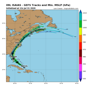
While earlier computer forecast model guidance suggested Isaias would curve out to sea, it is becoming more likely than not this afternoon that the storm will hug and impact much of the U.S. East Coast, with multiple landfall impacts possible along the way. It is likely more hurricane and tropical storm watches and warnings will be issued with time and possible that such watches may become necessary for the entire East Coast at times during the future progression of this storm.