Hurricane Lane is quickly losing punch, succumbing to the sheer and high terrain disrupting flow around the tropical cyclone. In an afternoon update, the Central Pacific Hurricane Center (CPHC) downgraded the system to a Category 1 hurricane with maximum sustained winds of only 85mph. While the storm is losing a punch when it comes to wind, it isn’t losing much of a punch with heavy rain: rain, heavy at times, continues to pour throughout much of Hawaii.

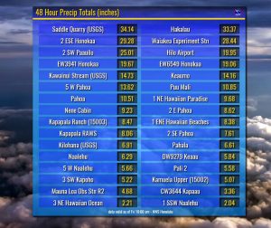
Extremely heavy rain has already flooded communities in the Aloha State. On Hawaii’s Big Island, 34.14″ of rain fell in 48 hours at Saddle Quarry. Hilo Airport had just under 20″ with more heavy showers continuing to spread into the state. A large area saw more than a foot of rain, with more rain falling as Lane stalls about off the coast of Hawaii. Much less rain fell in western Hawaii as the high peaks of Hualalai and Mauna Loa shielded the area from rain.
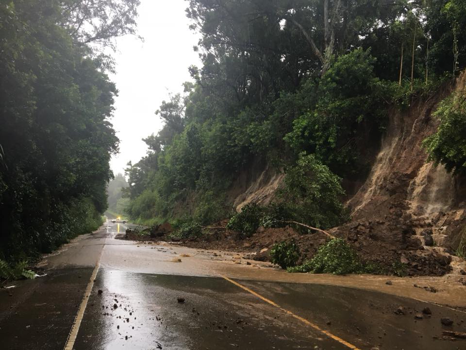
The rain triggered numerous rock, mud, and land slides throughout the state. On Hawaii’s Big Island, Hawaii County Civil Defense is reporting that there’s multiple closures between mile marker 14 and 29 on Highway 19, the only link from the eastern side of the island to the western side of the island from the north. Saddle Road, the only road that links the east and the west side across the middle of the state, was also severed earlier today. However, 1 lane is now open between mile markers 8 and 88 as crews remove rocks and debris from the flooding rains. “Numerous secondary roads in Hilo, Puna, and Hamakua are closed so stay alert, ” the Hawaii County Civil Defense agency warns. “Multiple other landslides are occuring on Highway 19 and other closures can occur without notice.”
Beyond carrying rocks, boulders, muds, and tree, the flood waters are also carrying harmful substances. The Hawaii Department of Environmental Management reports that there are three ongoing wastewater spills from pump stations along the Hilo shoreline. These spills are caused by abnormally high flows due to the heavy rainfall. The wastewater is being discharged on both the ground and at the shoreline. The same agency is warning the public to stay out of Kaohaoha Gulch, northwest of Hilo, and the coastal waters fronting the gulch in Ookala. Water within Kaohaoha Gulch was contaminated with animal waste from an overflowing retention pond at a nearby dairy facility. Throughout the islands, the bacterial count of coastal waters could be dangerously high as run-off meets the ocean.

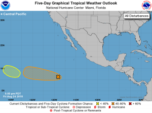
While flooding rains and gusty winds continue to soak and lash Hawaii, eyes are on two other areas of concern in the Pacific. The National Hurricane Center in Miami is monitoring two disturbances for possible tropical cyclone development. Of the two, an elongated area of low pressure located about 1,000 miles south-southwest of the southern tip of the Baja California peninsula appears to have the best chance to develop. It currently continues to produce disorganized showers and a few thunderstorms. Gradual development of this system is possible during the next several days, and a tropical depression could form by the middle of
next week while the system moves westward around 10 mph. It is possible this system would eventually become named Miriam as it moves closer to Hawaii over time. The second area which is closer to Hawaii is less likely to develop, but will be monitored by the National Hurricane Center nevertheless. An area of low pressure could form well to the east-southeast of the Hawaiian Islands in a couple of days. Development of this system, if any, should be slow to occur next week while it moves westward or west-northwestward at about 10 mph. For now, the National Hurricane Center believes there’s only a 10% chance of that system developing over the next 5 days.