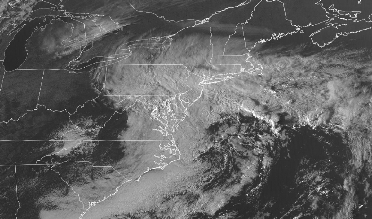
An Ian-influenced nor’easter continues to linger around the northeast coast, and will likely stay there through Thursday morning. In addition to creating breezy and wet conditions, the storm system is also driving water on-shore, creating coastal flood problems. The worst of the flood problems will be along the central and southern Jersey shore, Delaware beaches, and western portions of Long Island Sound in both Connecticut and New York. Because of those coastal flood threats, the National Weather Service has a variety of flood advisories in effect for those areas.
A coastal low continues to meander offshore, with light to steady showers streaming in from the Atlantic Ocean. This will be the continued theme for the rest of the evening with generally light off and on showers through the I-95 corridor and Lehigh Valley. According to the National Weather Service, RADAR currently shows some heavier rain just offshore, so coastal communities and parts of the New Jersey Coastal Plain could see a more steady rain at times. Areas in the Poconos and North Jersey will be rather dry, though a light shower can`t be ruled out up there.
A tight pressure gradient between the coastal low and an area of high pressure to the northwest will continue to create gusty winds. Gusts in the 30-40 mph range at the coast are being observed, with gusts up to 20-30 mph inland to the I-95 corridor. North and west of the I-95 corridor, away from New York City and Philadelphia, gusts of 15-25 mph are occuring.
Tonight, the coastal low will begin to meander back towards the west with the pressure gradient strengthening a bit. This will keep winds elevated, with gusts along the coast picking back up again tomorrow morning. The National Weather Service office in Mount Holly, New Jersey believes gusts up to 45 mph are possible at the coast.
With more clouds, wind, and rain in store for tomorrow, temperatures will be cool. With the raw conditions, temperatures should only climb into the low to mid 50’s for a daytime high for most of the region.
While a steady round of precipitation is expected in the morning, scattered showers will linger through the afternoon, similar to today. Highest rain totals will be over southern New Jersey, Delaware, and eastern Maryland.
Later on Wednesday, this low will start to drift to the east, with the storm finally leaving the northeast on Thursday morning.
Until the storm exists, northeast winds, clouds, and showers will continue, with the greatest chances of rain and strong wind gusts along the coastal plain.
