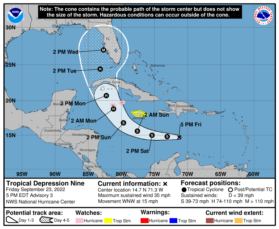
A new storm that isn’t even yet named is gaining attention in the Caribbean; a Hurricane Watch has just been issued for what will likely be named Ian soon. And with time, according to the National Hurricane Center’s latest forecast, Ian could be a major hurricane and landfall on the central Florida gulf coast sometime during the middle of next week.
For now, local authorities have issued a Hurricane Watch for the Cayman Islands including Grand Cayman, Little Cayman, and
Cayman Brac, and a Tropical Storm Watch for Jamaica. A Hurricane Watch means that hurricane conditions are possible within the watch area. A watch is typically issued 48 hours before the anticipated first occurrence of tropical-storm-force winds, conditions that make outside preparations difficult or dangerous. A Tropical Storm Watch means that tropical storm conditions are
possible within the watch area, generally within 48 hours.
The system getting attention is a tropical depression located about 430 miles east-southeast of Kington, Jamaica and about 930 miles southeast of Havana, Cuba. Maximum sustained winds are 35 mph while the minimum central pressure is at 1006 mb or 29.71″.
The National Hurricane Center (NHC) is forecasting that this storm will begin a westward motion tonight and continue through Saturday night, followed by a turn toward the northwest and north-northwest on Sunday and Monday. On the forecast track, the center of the cyclone is forecast to move across the central Caribbean Sea through Saturday, pass south of Jamaica on Saturday night and Sunday, and approach the Cayman Islands on Sunday night and early Monday.
The NHC also expects significant intensification of this tropical cyclone over the next several days. Some slow strengthening is forecast during the next day or so, and the depression is expected to become a tropical storm by tonight. When it reaches tropical storm strength, it will be named Ian. More significant intensification is forecast on Sunday and Monday, and the system is forecast to become a hurricane by early Monday. The official NHC forecast is calling for even more intensification, with the storm reaching major hurricane status by Wednesday morning with maximum sustained winds of at least 111 mph as it impacts the Florida Gulf coast.
While the NHC forecast brings Ian to the Florida coast somewhere between Naples and Tampa, it is still too soon to nail down a specific landfall point. As the NHC Forecast Cone shows, the center of the storm could impact as was west as Apalachicola on the Florida panhandle; it is also possible the storm could come up the eastern coast of Florida, impacting anywhere from the Keys to Miami to Jacksonville by Wednesday afternoon too.
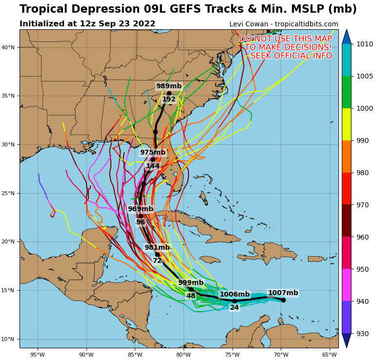
The latest American GFS Computer model suggests that beyond Florida, Ian could bring significant rain and wind problems to much of the eastern United States with time, with Alabama, Georgia, the Carolinas, the Virginias, Maryland, Pennsylvania, Delaware, New Jersey, and all of New England eventually dealing with the storm or its remnants. It may not be until after October 3 that Ian will finally depart the United States after what could be a very significant impact.
