Tropical Depression #9 has yet to strengthen into Tropical Storm Imelda, and that is good news for interests along the U.S. East Coast. While a direct impact of a landfalling hurricane is unlikely, there is a threat of flash flooding even far from the coast as the storm takes shape and moves up along the southeast coast.
As of the latest advisory from the National Hurricane Center (NHC), the tropical depression is located about 300 miles northwest of the eastern tip of Cuba and about 95 miles west of the central Bahamas. Maximum sustained winds are 35 mph while the minimum central pressure is 1002 mb or 29.59″.
The depression is moving toward the north near 7 mph; the NHC expects a faster motion to the north-northwest or north later today and continuing through Monday. On the forecast track, the center of the system is expected to move across the central and northwestern Bahamas later today and tonight and then turn east northeastward, moving away from the southeastern U.S. by the middle part of this week. The close proximity of Major Hurricane Humberto to its east will help draw this new system east. Strengthening is expected during the next few days, and the system is forecast to become a tropical storm later today and a hurricane by late Monday or Tuesday. Once the storm becomes a tropical storm, it will be given the name Imelda. But because this strengthening hasn’t happened as forecast, Humberto’s influence will help steer it away from a U.S. East Coast landfall. However, direct impacts to Bermuda are still possible while this storm is a hurricane.

Nevertheless many watches and warnings are in effect. A Tropical Storm Warning is in effect for the Central Bahamas, including Cat Island, the Exumas, Long Island, Rum Cay, and San Salvador, portions of the northwestern Bahamas, including Eleuthera, New Providence, the Abacos, Berry Islands, Andros island, and Grand Bahama Island. A Tropical Storm Watch is in effect for the east coast of Florida from the Palm Beach/Martin County Line to the Flagler/Volusia County Line. A Tropical Storm Warning means that tropical storm conditions are expected somewhere within the warning area, within 36 hours. A Tropical Storm Watch means that tropical storm conditions are possible within the watch area, generally within 48 hours.
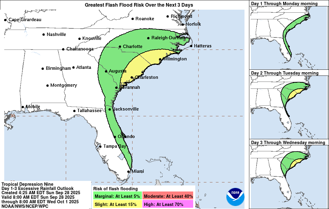
This system is expected to produce additional rainfall of 2-6″ across eastern Cuba and 6-12″ across the northwest Bahamas through Tuesday. This rainfall will likely produce flash and urban flooding. Mudslides are also possible in areas of higher terrain across eastern Cuba. Storm total rainfall amounts of 2-4″ with local maxima of 7″ are expected into Wednesday morning across portions of the coastal Carolinas. This rainfall could result in flash, urban, and isolated, minor river flooding. Changes in the forecast track could result in further adjustments to these rainfall totals.
