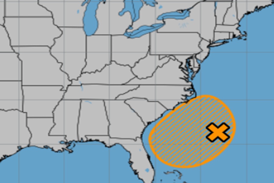
The National Hurricane Center has increased the odds that two areas they’re monitoring for tropical cyclone development in the Atlantic Hurricane Basin will grow into tropical cyclones. One threat area is located off the U.S. southeast coast while another is in the far eastern Atlantic. While these two areas are of concern, Tropical Storm Dexter isn’t; it is moving away from North America and is forecast to weaken over time.
A tropical cyclone is a rotating, organized system of clouds and thunderstorms that originates over tropical or subtropical waters and has a closed low-level circulation. It’s essentially a powerful storm system fueled by warm ocean waters, characterized by strong winds, heavy rainfall, and the potential for storm surge and flooding. Tropical cyclones are classified into different categories based on wind speed , with the weakest classified as a Tropical Depression. A tropical depression has maximum sustained winds of 38 mph or less. The next stronger tropical cyclone is a tropical storm; these have maximum sustained winds of 39 to 73 mph. Once these form, the National Hurricane Center issues them a name from a list curated by the World Meteorological Association with input from the United States. The strongest tropical cyclone is a hurricane. These have maximum sustained winds of 74 mph or higher and can get winds over 200 mph in the most severe storms. In the Atlantic and the Eastern and Central Pacific, this tropical cyclone is referred to as a hurricane but around the North Pacific, in places like Japan and China, they are called typhoons. In the Indian Ocean and South Pacific, a hurricane-strength tropical cyclone is simply called a “cyclone.”

The first area of concern is a weak surface trough located several hundred miles off the coast of the southeastern United States which is producing scattered showers and thunderstorms this afternoon. According to the National Hurricane Center, an area of low pressure is expected to develop from this system over the next day or so, where environmental conditions appear generally favorable for additional development. A tropical depression could form by the latter portion of this week or weekend as the low starts moving slowly westward, but turns more northward by this weekend. Right now the National Hurricane Center believes there’s a 40% chance of tropical cyclone formation here over the next 7 days.
A tropical wave over the far eastern tropical Atlantic is currently producing a disorganized area of showers and thunderstorms; while it is farther away, there is greater potential for a more significant storm to develop here than the one off the southeast coast. The National Hurricane Center says environmental conditions are forecast to be conducive for gradual development during the next few days, and a tropical depression could form late this week or over the weekend as the system moves generally west-northwestward across the central tropical or subtropical Atlantic. Odds that a tropical cyclone forms here over the next 7 days is now at 50%.