After a stretch of tame weather in the eastern United States, it appears Old Man Winter will be making a return as meteorologists monitor snowstorm threats in the coming week. The weekend will be ending on a dreary note in portions of the Mid Atlantic today; while temperatures will be above normal, clouds will be low and rain showers and drizzle will be abundant. As this system departs though, the weather pattern should change in the east, setting the stage for more wintry than wet weather conditions.

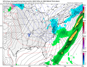
An upper-level trough gradually amplifying into the East tonight will continue to provide some energy to an offshore surface front. This will allow some ripples of low pressure to track along the boundary. helping produce rain over portions of southern New Jersey, Delaware, Maryland, and Virginia. While the air mass will be cooling from northwest to southeast, temperatures will remain mild enough to support simply rain here for now. However, as a coastal low deepens and more cold air fills in behind it on Monday into Tuesday, a changeover to snow is expected in portions of the northeast.
The coastal low should deepen and move from just off the North Carolina coast on Monday to about 300 miles east of the Jersey Shore by early Tuesday morning. As that low moves off shore and deepens, a race will be on to see if cold air can catch up quick enough to change rain to snow even at the coast. At this time, it appears rain will change to snow in the Mid Atlantic later Monday into Tuesday, but snow accumulations, if any, will be very light. For the I-95 corridor between Baltimore and New York, it appears light rain may mix with or change to light snow during the Monday PM commute. However, frozen precipitation will be limited and accumulations, if any, would likely remain on grassy surfaces rather than paved ones.
After a brief break in the precipitation Monday evening, light snow will return early Tuesday. An approaching upstream shortwave trough from the Ohio Valley should provide just enough atmospheric lift to create light snow across Pennsylvania, New Jersey, Delaware, and Maryland. and northeastern Virginia. Some flurries may make their way into the New York City area, but most light snow should be confined south and west of the Big Apple. Snow will be light, with accumulations generally in the 1-2″ range. However, it is possible that mesoscale banding will set up in portions of southeastern Pennsylvania, southern New Jersey, and Delaware on Tuesday morning, which could enhance snowfall and accumulations by an inch or two in localized areas there.

Once this pesky low pressure system and trough departs the region Tuesday, high pressure will build in from the west Tuesday night. This high will eventually move off the East Coast by late Wednesday night. On Thursday, a cold front will slowly approach from the north and west. Before the front arrives, milder air will arrive due to the circulation of air around that high pressure system. With mild air initially in place, rain is expected to break out as low pressure forms over the southern Great Plains and northern Gulf Coast region on Thursday.
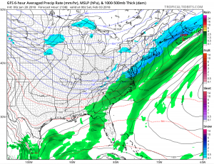
For Groundhog’s Day on Friday, February 2, that low pressure system will invade the Mid Atlantic, bringing more rain up the coast. While the low moves up, cold air will be moving south, changing the rain over the snow from north to south. Precipitation type will be highly dependent on the track of this low and the arrival timing of cold air ahead of a strong high pressure building in from the Upper Midwest. Forecast guidance from both the American GFS and European ECMWF models suggest the cold air will win while precipitation is in place along the I-95 corridor from Baltimore, MD to Boston, MA. As a result, accumulating snow is becoming more likely for places like Philadelphia and New York City and the snow may be significant enough to plow by Friday evening. Precipitation from this system should end from west to east Friday night, with fair, dry, and cold conditions expected in the northeast for next Saturday.