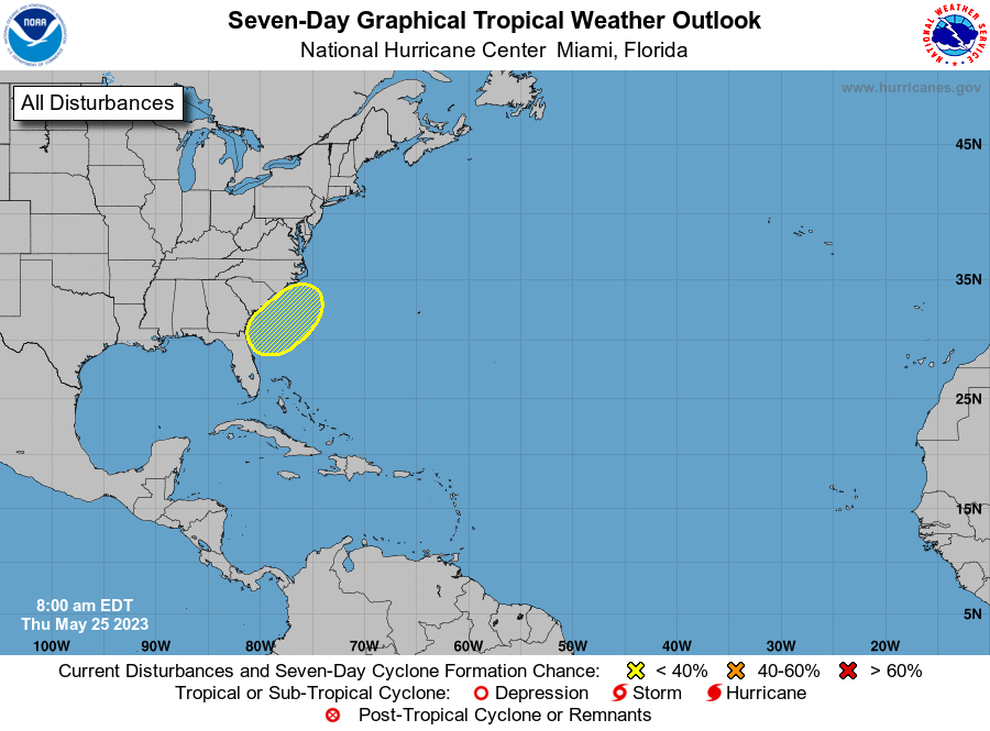
While the Atlantic Hurricane Season doesn’t begin until June 1, the National Hurricane Center (NHC) is busy tracking a disturbance expected to form off of the U.S. East Coast. At this time, the NHC does not expect the system to become tropical in nature, but still expects the system to bring considerable rain and wind to the Mid Atlantic as the Memorial Day Weekend kicks off.
According to the NHC and their latest Tropical Outlook issued today, a non-tropical area of low pressure is expected to form along a frontal boundary offshore of the southeastern United States coast within the next day or two. The system appears unlikely to become a subtropical or tropical cyclone since it is forecast to remain frontal while moving generally northward and inland over the Carolinas this weekend.
Regardless, the system is likely to produce gusty winds and dangerous surf and rip current conditions along portions of the southeastern United States coast late this week and into the weekend. Heavy rainfall is expected in portions of the Carolinas with hazardous marine conditions expected over the coastal and offshore waters where gale warnings are in effect.
The worst of the weather is expected on Saturday across North and South Carolina, where the system will rain-out and dissipate over the balance of the weekend. The heaviest rain should fall over North Carolina, with a moderate amount of rain expected in Virginia, especially southern Virginia. Impacts are not expected north of there across Maryland, Delaware, New Jersey and points north at this time.