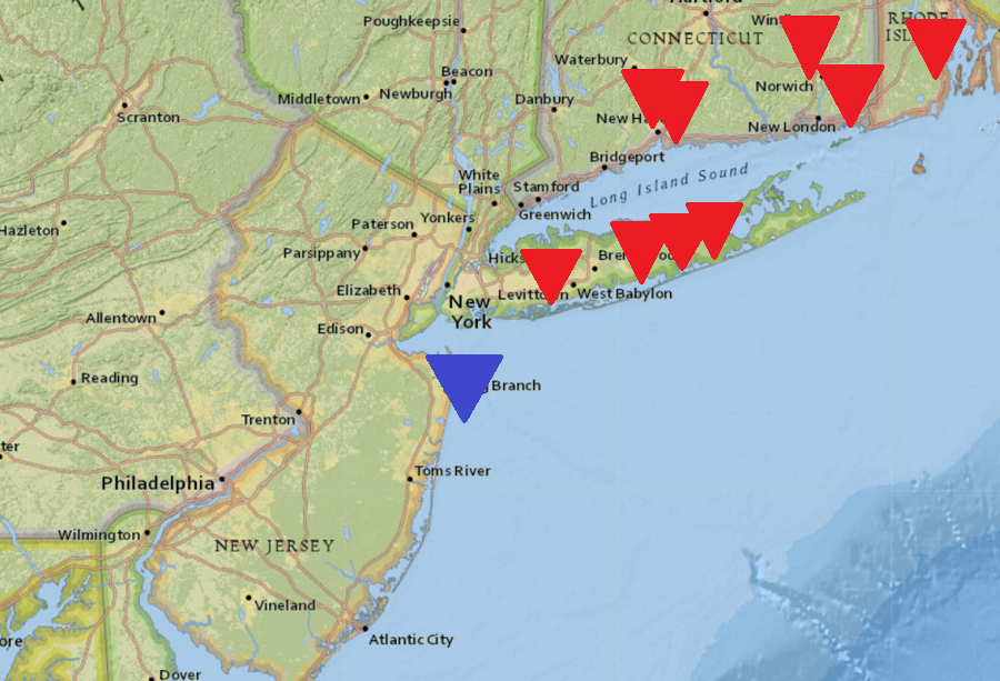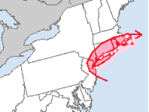
The National Weather Service has confirmed that 9 tornadoes touched down across portions of New York, Connecticut, and Rhode Island on Saturday while a waterspout was observed off the Jersey Shore as severe weather moved through the region. Since 1950, there was never a tornado recorded in Connecticut or Rhode Island in the month of November; 2021 clearly shatters that record.
The National Weather Service uses the Enhanced Fujita Scale to classify tornadoes. Weak tornadoes of 65-85 mph are rated EF-0 while weak tornadoes with winds of 86-110 mph are considered EF-1. A EF-2 with 111-135 mph is considered strong, while an EF-3 with winds of 136-165 mph is also considered strong. EF-4 and EF-5 rated tornadoes are considered violent; EF-4 has winds of 166-200 mph while EF-5 has winds in excess of 200 mph.

On Saturday’s severe weather event, 3 EF-0 and 1 EF-1 tornado touched down in New York while 3 EF-0 and 1 EF-1 tornado touched down in Connecticut, with some wandering into Rhode Island too. An EF-0 touched down wholly in Rhode Island in the severe weather event. While there were no confirmed tornado touch downs in New Jersey, a waterspout was observed off the coast of Ocean Grove.
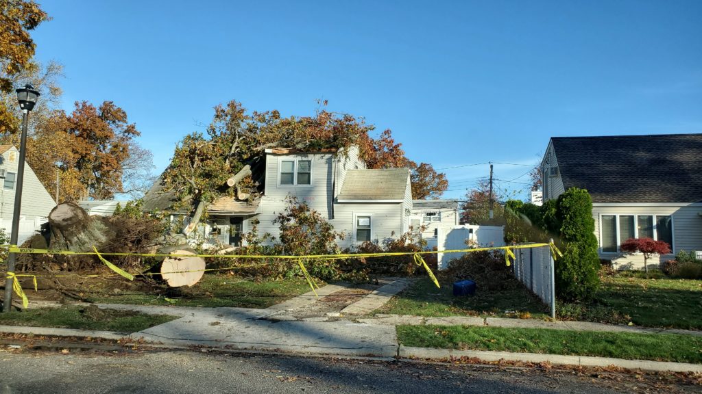
One EF-0 tornado touched down in multiple locations in Nassau County, New York. According to the National Weather Service, a tornado with maximum sustained winds of 85 mph briefly touched down in Woodmere where several trees and powerlines were down. From there, the tornado lifted and skipped in a few locations as it traveled nearly 50 mph to the northeast toward Hempstead, Uniondale, and Levittown. The tornado touched down again in Uniondale, tearing the roof off of a two-story colonial building on Liberty Street which landed on a nearby house. Scattered debris, including shingles, insulation, and twisted siding was thrown into the next block up. Significant damage was also noted near Clover Lane in Levittown, where a large tree fell onto a house before the tornado lifted.

Another EF-0 tornado touched down in Suffolk County, New York. A narrow 50-yard wide tornado touched down at the southwestern end of Hollins Lane in East Islip and continued northeast over Brushwood Court, Bayview Avenue, Josephine Lane, and Kay Court. It then lifted over the John F. Kennedy Elementary School sports fields. The National Weather Service storm survey team observed a few dozen large oak, maple, and pine trees uprooted and laying in an east or northeast direction here. Minor roof and siding damage was observed on several houses as well as leaf splatter on south and east sides of several houses. This tornadic circulation was likely on the northwest side of a 400 yard swatch of 65-70 mph west to southwest straight line winds causing isolated large trees to be uprooted and several large limbs broken. After passing through the sports fields, it appears the tornado touched down again in the Frog Lane and Jade Street area of Oakdale, resulting in a very large oak tree to topple onto and destroy a home.
An EF-1 tornado touched down around Shirley and Manorville, New York in Suffolk County too. The tornado touched down just southwest of Francine Place and Mastic Boulevard, travelling east-northeast along the Long Island Railroad tracks and adjacent backyards, knocking over numerous oak, maple, and pine trees. Minor roof and siding damage was observed here along with leaf splatter. The tornado then hooked northeast over the LIDL Supermarket, flipping over a 5 ton air handler unit on the roof before tearing off the parapet and collapsing the covered walkway of the Chipotle Mexican Grill at the shopping center. The damage path remained about 25 yards there, but the National Weather Service says damage observed was consistent with EF1 winds of 95-105 mph. After impacting the Chipotle, the tornado lifted northeast across the intersection of William Floyd Parkway and Montauk Highway towards the Applebees Shopping Center. Siding and shingles from the Chipotle were thrown northeast about 250 yards across this intersection into the Applebees shopping center. Flashing was ripped off the south side of the Applebees and adjacent retail store. After briefly lifting, the tornado touched down again, lifting the entire roof off a 2-story multi-family residence on the corner of Grand Avenue and McGraw Street. The rood was tossed as far as 150 yards to the north into the backyard of neighboring houses. One section of the roof impaled itself into the side of the neighboring house to the north; the National Weather Service said the impact was so great that it skewed the vertical structure of that house. Based on damage there, winds were likely 110 mph, making it the peak strength period of the tornado. From there, it went north across Sunrise Highway, skipping its way through Brookhaven Calabro Airport, where a few single engine planes were flipped or shifted. Siding damage, downed trees, and broken wires were observed along the balance of this tornado path.
Today, it was determined that another EF-0 tornado touched down from Remsenburg to Westhampton in Suffolk County too. Suffolk County Fire Rescue and Emergency Services and New York State Division of Homeland Security and Emergency Services Long Island Sector assisted the National Weather Service with their preliminary damage assessment there.
Beyond the four tornadoes in New York, four touched down in Connecticut.
A narrow tornado with only a 25 yard with has been confirmed to have a touch-down in New Haven County in Branford, Connecticut. The EF-0 tornado touched down near Pine Orchard and Oak Hollow Roads and continued northeast, widening to a 300 yard damage area at the Francis Walsh Intermediate School field. At the school, several light tower generators were all toppled by straight line winds while the eastern 100 yards of this area along Sunset Hill Drive continued to show a convergent damage pattern. This tornado continued to the top of Whiting Hill Road where the path narrowed to about 75 yards. It was at this point where damage was most intense. The damage path continued northeast to Gould Road where the tornado lifted just before reaching the Governor John Davis Lodge Turnpike.
Also in New Haven County, another EF-0 tornado touched down in Cheshire, Connecticut. The tornado touched down along Mountain Road just south of Higgins Road and continued northeast with sporadic tree damage. More significant tree damaged occured on the grounds of the Legion of Christ College of Humanities on Oak Road. Damage path continued to the back of the Main Street Cade and along West Main Street and to the intersection of George Avenue and Mueller Avenue where a SUV and RV were crushed. Peak winds in this tornado were estimated to be 75 mph.
An EF-1 tornado touched down in Stonington in New London County, Connecticut, traveling 1.35 miles into Westerly in Washington County, Rhode Island. The tornado first touched down on Robinson Street in the Pawcatuck neighborhood; here, trees snapped and gutters and siding were ripped off of homes. Several trampolines were lifted, with one becoming stuck on a powerline roughly 20 feet in the air. On Robinson Street, a metal shed was lifted and flipped before being crushed by a large maple branch with an approximate diameter of 15″. In addition to damaging street signs and snapping small trees, the tornado uprooted about 20 large, healthy hardwood trees in Westerly. A wood outbuilding was also flipped onto its side. The tornado crossed onto Hillview Drive and finally lifted.

The fourth tornado to touch down in Connecticut was an EF-0 which struck Plainfield and traveled to Foster in Rhode Island. The storm had a 6.1 mile long path with a maximum width of 100 yards. While there were no injuries or deaths here, there was damage to trees and buildings. Peak winds were estimated to be 80 mph.
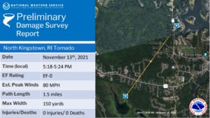
The final tornado to strike Rhode Island touched down in North Kingston. The EF-0 tornado with estimated peak winds of 80 mph traveled a distance of 1.5 miles with a path width of about 150 yards.
In New Jersey, a waterspout was observed off the Monmouth County coast near Ocean Grove. The National Weather Service office in Mount Holly, New Jersey shared footage of the tornado online.
Another impressive video from today, this one of what is definitely a waterspout just off the Monmouth County coast. #NJwx https://t.co/nwdl4h3yyu
— NWS Mount Holly (@NWS_MountHolly) November 14, 2021
Tornadic waterspouts are tornadoes that form over water, or move from land to water. They have the same characteristics as a land tornado. They are associated with severe thunderstorms, and are often accompanied by high winds and seas, large hail, and frequent dangerous lightning.