While a State of Emergency has been issued for New Jersey and officials are preparing emergency assets in New York, new data in suggests conditions may not be as severe as initially thought for those two states this Sunday into Monday. The latest forecast models, including the global computer forecast giants from America (GFS) and Europe (ECMWF), have backed off on the most severe solutions suggested yesterday evening, bringing a substantial bot not overly significant coastal storm up the east coast.
The National Weather Service office in Mount Holly, New Jersey shed some light on the forecast complexity in their Forecast Discussion issued this evening. They write, “There still remains a fair amount of certainty regarding the details of the evolution of the coastal storm and its ultimate degree of impacts. There are still 2 potential solutions, which are most evident in the differences between the 12Z GFS and NAM model runs. A stronger storm that tracks closer to the coast will result in much more severe impacts (similar to the 12Z NAM solution). A somewhat weaker storm that tracks farther offshore, (like in the latest GFS runs, as well as previous runs of other global guidance) will result in less severe, but still potentially significant impacts to the immediate coast.”
Of note, the National Weather Service adds, “Guidance will likely continue to struggle and vary from run to run with this system until it actually forms a well defined low pressure center sometime Saturday or Saturday night.”
With uncertainty in the forecast, all previously issued watches remain in effect at this time due to the continued uncertainty in timing, severity, and inland extent of impacts.
The latest American GFS forecast model still brings rain and wind into New Jersey and New York, along with the threat of significant coastal flooding. However, it shows a much less robust storm than it did earlier and keeps the worst wind and rain off-shore.
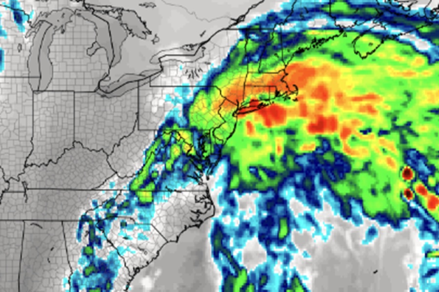
While the GFS model brings the storm close to New Jersey and New York, the European ECMWF model develops the system well off shore, keeping much of the rain and wind over the Atlantic Ocean than on land. Based on where it puts the developing coastal storm, Cape Cod would see worse impacts than Long Island or New Jersey.
While forecast models are trending towards a weaker solution, it is possible they could trend in the opposite direction as the low finally takes shape Saturday evening.
Until then, the National Weather Service continues to deliver three key messages for the strong coastal low: major coastal flooding is likely in the Mid Atlantic, strong rip currents and beach erosion is likely from high surf, and there could be damaging wind gusts and heavy rain.
“The combination of strong onshore winds, high surf, and high astronomical tides will likely lead to major coastal flooding in the Mid Atlantic, especially along the coasts of Delaware, southern New Jersey, and the Virginia Tidewater,” warns the National Weather Service. “This would flood roadways, and could affect some homes and businesses near the waterfront. Coastal residents are urged to heed warnings and follow guidance from local officials.”
Even if the storm is weaker or forms east and more off-shore, dangerous surf is likely. “High surf is expected on many East Coast beaches, which will generate strong, dangerous rip currents and likely lead to areas of beach erosion,” the National Weather Service warns. They advise even experienced swimmers and surfers avoid the ocean until the storm threats have passed.
“Wind gusts in excess of 55 mph along and near the Mid Atlantic and southern New England coastlines may lead to scattered power outages and damage,” warns the National Weather Service. They add, “heavy rain in the Mid Atlantic may lead to isolated to scattered instances of flash flooding.”
As more data comes in, the National Weather Service will likely refine their forecasts and adjust storm related watches and warnings during the day on Saturday.
