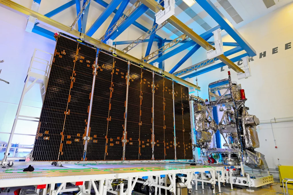
The advanced new GOES weather satellite has returned its first stunning images of the planet back to Earth; after additional testing, the satellite will be shifted over the Pacific and will collect images and data across Hawaii, the central and eastern Pacific Hurricane Basins, and the U.S. West Coast. Initially known as the GOES-T weather satellite, the rocket was launched from Florida’s space coast on March 1. Once it reached its geostationary orbit high above the Earth at 22,236 miles above it, the satellite was re-named GOES-18. Once testing is complete and the satellite moves over the Pacific, it will be renamed GOES-West. The existing GOES-West will go into “storage”, floating above the Earth as a backup should any of the other GOES satellites fail.

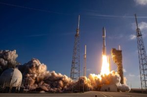
A United Launch Alliance (ULA) Atlas V rocket lifts NOAA’s newest weather satellite into space on March 1. Image: ULA
“We at NASA are proud to support our joint agency partner, NOAA, and their mission to provide critical data and imagery to forecasters and researchers tracking hazardous weather,” said NASA Deputy Administrator Pam Melroy after the launch. “While the GOES-R series satellites’ main job is to help with weather prediction, these satellites produce observations that also help with NASA science. Our agencies’ collaboration brings great benefits toward understanding our planet.” This GOES-T satellite is the third in the GOES-R series to return imagery to Earth, the others being GOES-S which is currently acting as GOES-West.

With the satellite fully powered, the satellite was sent to its its 89.5 degrees west longitude initial checkout position, between the operational GOES-East and GOES-West satellites. Once it got there, the magnetometer boom was deployed, kicking-off an on-orbit checkout and validation of its instruments and systems.
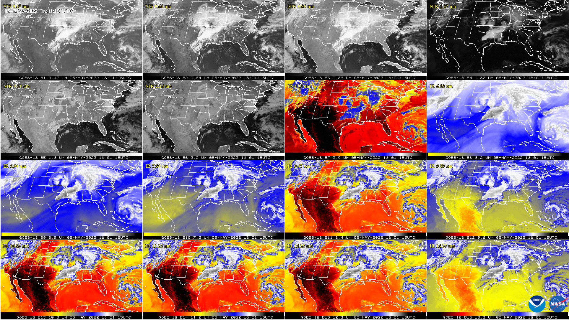
This week, the first images from the satellite’s Advanced Baseline Imager (ABI) were beamed back to Earth. The ABI provides high-resolution imagery and atmospheric measurements for short-term forecasts and severe weather warnings. ABI data is also used for detecting and monitoring environmental hazards such as wildfires, dust storms, volcanic eruptions, turbulence, and fog.
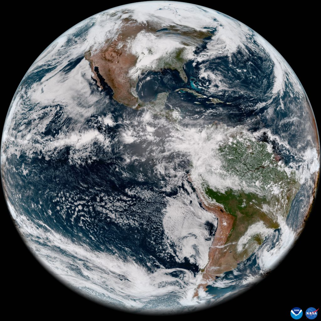
Data from multiple ABI channels can be combined to create imagery that approximates what the human eye would see from space—a result known as GeoColor. Combining data from different channels in different ways also allows meteorologists to highlight features of interest.

After a successful testing routine, GOES-18 will take over as the operational GOES-West satellite by early 2023, replacing GOES-17. NOAA plans to continue to maintain GOES-17 as a back-up should anything happen to this new GOES-West or the older GOES-East weather satellite, both of which provide continuous weather satellite coverage over the United States and adjacent oceanic waters.