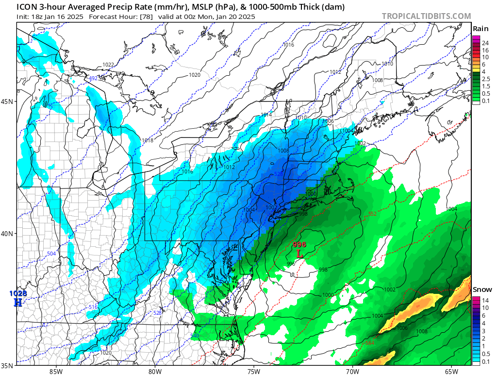
Odds continue to grow that a snowstorm will develop and impact portions of the northeast on Monday, including the heavily trafficked I-95 corridor between Philadelphia, New York City, and Boston. A storm system is likely to form along an approaching Arctic front, setting the stage for a winter storm. However, details are still coming together on how robust this storm will be and it is too say to say with certainty where the heaviest snow will fall and where a rain/snow line will set-up.
For Sunday into Sunday night, a strong Arctic cold front will cross through the Mid Atlantic early Sunday morning advecting a much colder airmass into the northeast during the day. As it does so, an area of low pressure will also be developing over the Deep South near the tail-end of the arctic front. This area of low pressure will ride along the frontal boundary and strengthen as it moves off of the Carolina coastline by Sunday afternoon.
From here, computer model forecast guidance varies greatly and ultimately will determine what will occur Sunday afternoon into Sunday night. If the track of the low is close enough to the coast, a large portion of theI-95 corridor will see a significant accumulating snowfall. If the track of the low is suppressed further south and east, it’s possible accumulating snow may be confined to coastal areas. If the track of the low hugs the immediate coastline, then the most significant snows will be focused north and west with rain along the Jersey Shore and points south.
According to the National Weather Service, regardless of the variance in global computer forecast guidance, there has been a noticeable increase in overall moisture values and in snow probabilities. Because of that, there is an increase in forecaster confidence that accumulating snow is on the table Sunday afternoon/evening especially since cold air will be advecting in from the northwest.
Several inches of snow could fall, making it a plowable event. The speed of the system makes it unlikely the storm will produce more than 8″ in any one location. But additional data needs to be crunched before a snowfall forecast is made for this next system.