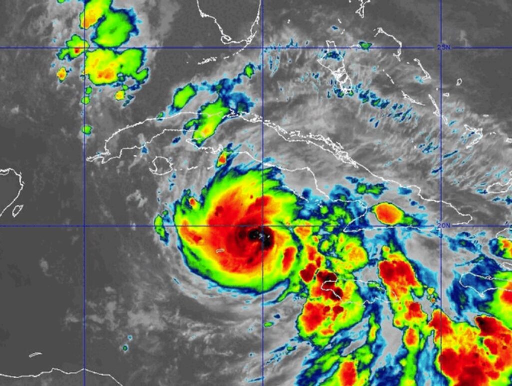
The National Hurricane Center (NHC) upgraded Tropical Storm Rafael to Hurricane Rafael today. The storm is forecast to rapidly intensify as it advances towards western Cuba; beyond that, the NHC expects the storm to enter the Gulf of Mexico and remain there for several days. Rafael’s maximum sustained winds are up to 85 mph right now.
“Environmental conditions are very favorable for continued intensification, and given that Rafael now possesses a tight inner core and eyewall, rapid intensification seems likely,” the NHC said in their latest update on Hurricane Rafael.
Right now, the hurricane is about 60 miles east-northeast of Grand Cayman and about 275 miles south-southeast of Havana, Cuba. Rafael is moving toward the northwest near 13 mph. A general northwestward motion is anticipated over the next day or so, followed by a gradual west-northwestward turn in the Gulf of Mexico. On the forecast track, Rafael is expected to pass through the Cayman Islands tonight, be near or over western Cuba on Wednesday, and move into the southeastern Gulf of Mexico by Wednesday night. Additional rapid strengthening is forecast over the next 12-18 hours, and Rafael is now forecast to become a Category 2 hurricane before it makes landfall in Cuba on Wednesday. Rafael could briefly weaken over Cuba but is then expected to emerge into the southeastern Gulf of Mexico as a hurricane.
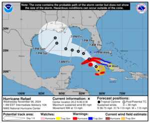
For now, the National Weather Service has issued a Tropical Storm Watch for south Florida across the Lower and Middle Florida Keys from Key West to west of the Channel 5 Bridge and the Dry Tortugas. According to the National Hurricane Center, tropical storm conditions are located in this part of Florida beginning Wednesday and Wednesday night.
“It is too soon to determine what, if any, impacts Rafael could bring to portions of the northern Gulf Coast, ” warns the National Hurricane Center. The latest forecast cone stalls the storm in the northern-central part of the Gulf of Mexico by the end of the weekend. At this time, the NHC does not yet have a forecast of a U.S. landfall made.
