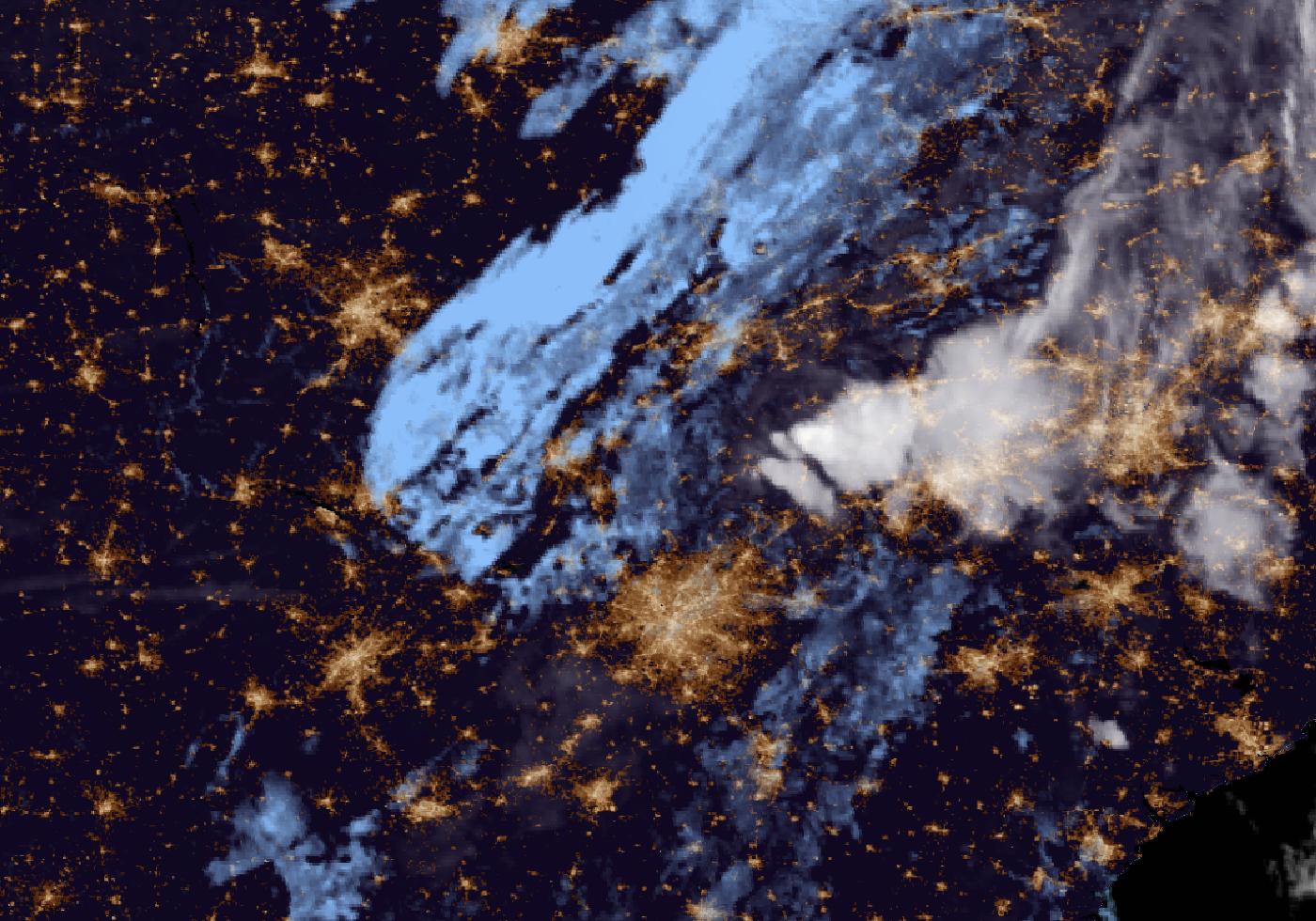
Floodwaters from the Toccoa River, which is called the Ocoee once it crosses into Tennessee, poured through the twin border towns of McCaysville, Georgia, and Copperhill, Tennessee, before dawn Thursday. Homes and businesses sat under several feet of water, and rescuers pulled at least 30 people to safety. Forecasters said the river rose to a level likely never recorded there before.
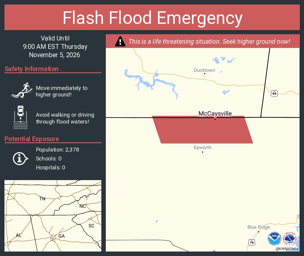
The National Weather Service declared a flash flood emergency for McCaysville and Copperhill, a rare warning saved for cases where severe threat to life and catastrophic damage are happening or about to happen. At 6:23 a.m. EST, the weather service office in Morristown, Tennessee, said that “widespread catastrophic flash flooding is ongoing with numerous businesses and homes under several feet of water” in Copperhill.
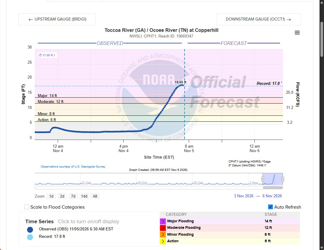
At 7:01 a.m. EST, the Morristown office said the Toccoa/Ocoee River at Copperhill had “crested at just over 18 ft this morning.” The office added that “it will take quite some time for the flood waters to recede.”
A River Beyond Its Banks
The weather service considers 14 feet major flood stage on the Copperhill gauge. Federal river data showed the gauge at 17.99 feet at 6:30 a.m. EST Thursday. The highest crest in the gauge’s historical record is 17.75 feet, set on Feb. 16, 1990.
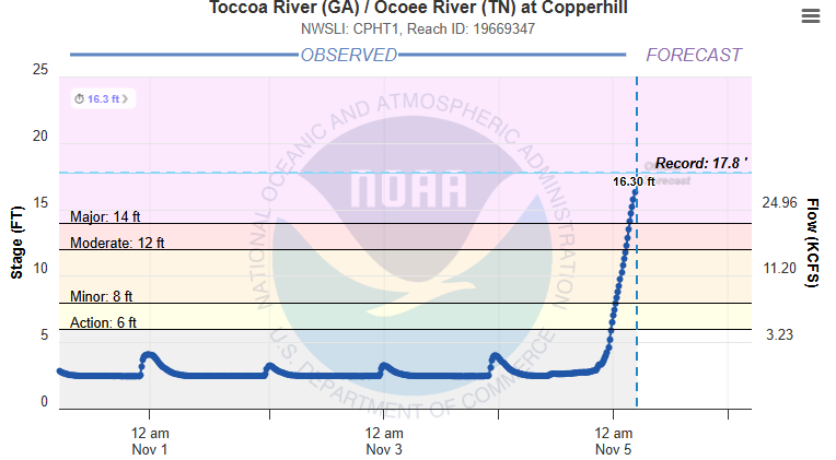
FOX 5 Atlanta meteorologist Alex Forbes posted Thursday morning that the river “just passed a record crest in McCaysville” and that the 1990 mark “has been defeated.” River gauge readings during floods are preliminary until reviewed.
The water rose quickly. At 3:58 a.m. EST, the Morristown office reported that the Ocoee River had reached major flood stage and was 3 feet from its all-time peak. By 5:22 a.m., the office said Copperhill was within 18 inches of the highest level ever recorded, in 1990.
The NWS office in Peachtree City, Georgia, which serves the Atlanta area, extended its flash flood emergency for north-central Fannin County until 9 a.m. EST. Its 6:39 a.m. warning said 3 to 5 inches of rain had already fallen and no more was expected. The warning still urged residents: “SEEK HIGHER GROUND NOW!”
Before dawn, a broader warning covered Fannin, Gilmer, Murray and northwestern Union counties. It said radar and gauges showed 3 to 6 inches of rain. Flooding was expected in or near Chatsworth, Ellijay, Blue Ridge, East Ellijay, Morganton, Cherry Log and Mineral Bluff.
FOX Weather reported that 5 to 8 inches of rain fell over about 12 hours, pushing the Ocoee into major flood stage. The rain came from a cross-country storm that FOX Weather said will affect more than 35 states and about 120 million people.
Evacuations, Rescues and a Floating Patrol Car
FOX Weather reported that just before 3 a.m., McCaysville police asked residents of some neighborhoods to evacuate. At about 5:20 a.m., the city declared a state of emergency, WSB-TV reported. It closed every access point to the public: River Road, Mobile Road, Blue Ridge Drive and Georgia Highway 68 coming in from Tennessee.
Police Chief Michael Earley said the closures were mandatory and that McCaysville was closed to all unauthorized personnel. Earley also serves as the city’s public safety director.
“Our community is once again experiencing significant flooding, and several downtown businesses and shops have already been impacted by rising floodwaters,” Earley said in a statement reported by WSB-TV. “Unfortunately, this flooding is not limited to the City of McCaysville.”
“It is heartbreaking to witness our community, our neighboring communities, and our local businesses facing yet another devastating flooding event, especially after the hardships so many have already endured,” he said.
FOX 5 Atlanta reported that as of 6 a.m. at least 30 people had been rescued in McCaysville, with crews from Georgia, Tennessee and North Carolina responding. Earley told the station that water had reached above rooftops and that a police car floated down a downtown street. He said he did not know of any confirmed injuries. A FOX 5 crew saw one woman being placed into an ambulance.
Fannin County Emergency Management Agency spokesman Robert Poole told 11Alive that crews were also searching for a driver.
“We currently have a crew looking for a vehicle. A gentleman called in, said he was swept away in his car down a creek,” Poole said.
Poole said several structure fires sparked by lightning added to the strain on emergency crews.
“We really do have our resources stretched out right now, so, just shelter in place if you can, so you don’t become part of the problem,” he said.
FOX Weather said Fannin County EMA reported that Georgia State Patrol helicopters were on standby to help with rescues.
Roads Washed Out Across Fannin County
The flooding reached well past downtown McCaysville. FOX 5 Atlanta reported that the Bushy Head Road bridge near Boardtown Road had washed out and that a mudslide hit Boardtown Road. The station also reported washouts on Lucius Road near Highway 76 in Cherry Log and on Moorestown Road at Sugar Creek. Downtown Blue Ridge also flooded.
McCaysville police told drivers to avoid Blue Ridge Drive at the bridge and the Steel Bridge, which were both closed, according to WSB-TV and NewsChannel 9 in Chattanooga.
FOX 5 Atlanta reported that Fannin County and Gilmer County schools closed Thursday. The station said a shelter was open at the Fannin County Recreation Center, 370 Tom Boyd Road in Blue Ridge.
Dam Operations Downstream
The Tennessee Valley Authority manages the reservoirs on the Toccoa and Ocoee. TVA spokesman Scott Fiedler told NewsChannel 9 that the agency had been running a flood control operation since Nov. 3, holding back water at Blue Ridge. Fiedler said the Ocoee No. 3 Dam was spilling 150,000 gallons per second. TVA asked people to stay away from the river.
In Tennessee, the weather service said in a flood warning that several structures had flooded in south-central Polk County. Ducktown was also under a flash flood emergency Thursday morning. Southwestern Cherokee County, North Carolina, including the Culberson area, was also under a flood warning.
What Comes Next
The rain is over, but forecasters said the danger is not. The Morristown office urged people to “continue to exercise extreme caution and follow orders of local emergency management and law enforcement officials.”
Forecasters said the cold front behind the storm will clear the region Thursday and bring much drier air. In its forecast discussion, the Peachtree City office said rain chances would stay at 10% or less into the middle of next week. It said frost or freeze products may be needed for far north Georgia on Sunday and Monday. The Morristown office said many places in East Tennessee could see their first frost Saturday night.
Earley asked residents to pray for displaced families and first responders.
“We are one county, and when one of our communities suffers, we all feel that pain,” he said. “We have faced difficult times before, and through faith, strength, compassion, and unity, we will continue to stand together and help one another through these challenges.”
