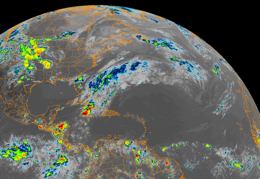
The second week of the Atlantic Hurricane Season, which began on June 1, is starting off on a quiet note with no tropical cyclones in the basin nor any expected to develop over the next 5-7 days, according to the National Hurricane Center.
There is, however, a non-tropical disturbance producing excessive amounts of rainfall in eastern and central Cuba and the Central Bahamas. The National Hurricane Center says an upper level trough located over the eastern Gulf of Mexico with southwest flow extending down to the surface is transporting a large amount of moisture northward from the deep tropics, creating an atmospheric river over Cuba and the Central Bahamas. Over the past 24 hours, Las Mercedes in Granma, Cuba reported 14″ of rainfall. Additional reports show 24 hour rainfall amounts ranging from 8-12″ elsewhere in Granma, Santiago de Cuba, and Camaguey where life-threatening flooding has been reported. In the Bahamas, 8″ was reported on Exuma and 4″ was reported on Long Island over the past 24 hours. Persistent convection in eastern and central Cuba and the central Bahamas is forecast to produce another 4-6″ of rain over the next 24 hours.
Areas experiencing heavy rain will see flooding and mudslides; the risk is greatest in the mountainous areas of eastern and central Cuba. Conditions are forecast to improve late Saturday in this region.