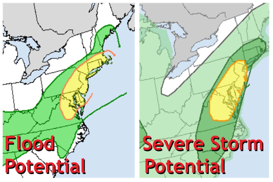
The National Weather Service’s Storm Prediction Center (SPC) and Weather Prediction Center (WPC) are warning about the potential of severe storms and flash flood threats in portions of the Mid Atlantic today and tomorrow, with today being the greatest threat of both.

The remnants of post-tropical cyclone Chantal are in the process of transitioning into an open trough while exiting east of Cape Cod early today as it continues to get caught up in increasing southwesterlies downstream of a trough approaching from the Great Lakes. This trough will continue to move eastward through the day, but will be slow to do so due to downstream Bermuda-type ridging. Between these two features, southwest flow will remain prevalent over the area, setting the stage to produce an extremely moist environment able to produce more than 2″ of rain in a short period of time from eastern Virginia into southern New England.
“Into these impressive thermodynamics, a subtle shortwave will traverse northeast ahead of a cold front and along a surface trough, providing additional ascent atop the already impressive convergence on these boundaries,” the WPC said. Because of this, showers and thunderstorms will likely become numerous to widespread along and near the front during the mid to late afternoon, and storm motions are expected to initially be quite slow with the potential for localized backbuilding and training along the surface trough and front. The atmosphere will support efficient warm-rain processes and rain rates above 2″/hour at times resulting in localized hourly totals of 1-2″. Where training occurs, this could result in total rainfall in excess of 3″.

The WPC warns that scattered instances of flash flooding are possible across much of the I-95 corridor from Richmond, Virginia to Boston, Massachussetts.
While the WPC is warning about the flood threat, the SPC is warning about the severe weather threat today.
According to the WPC, Early-morning water-vapor imagery from NOAA’s GOES-East weather satellite depicts a notable short-wave trough over the upper Mississippi Valley, shifting east. This feature is forecast to push into the central
Great Lakes region later today. As the short wave advances east, a corridor of higher atmospheric moisture content will be shunted downstream as a low-amplitude disturbance ejects toward the Mid Atlantic. Atmospheric conditions are favorable for clusters and short line segments of thunderstorms to form. With very high atmospheric water content available, damaging downbursts are likely, especially with any organized clusters. While an isolated tornado cannot be ruled out, the dominant threat from today’s severe weather potential is in the form of damaging severe wind gusts.
Due to these threats, Flood Watches are up for much of the region. Severe Thunderstorm Watches and/or Warnings may become necessary later today as thunderstorms fire up as the atmosphere warms through daytime heating.